Search
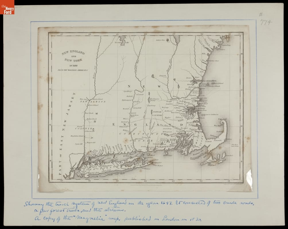
- Map of New England and New York in 1697 - This map, engraved and published in London, England, shows the importance of water routes in the settling of early America. Two crude roads are drawn on the map -- both part of the Boston Post Road, established by the English government in 1673 as a mail-carrying route. This road network later extended to New York State.
- 1697
- Collections - Artifact
Map of New England and New York in 1697
This map, engraved and published in London, England, shows the importance of water routes in the settling of early America. Two crude roads are drawn on the map -- both part of the Boston Post Road, established by the English government in 1673 as a mail-carrying route. This road network later extended to New York State.
- Steel Engraving, "View of the Canal [Aqueduct] at the Little Falls Mohawk River," 1831 - The first half of the 19th century was the heyday of canal construction in the United States. The Erie Canal, connecting Albany, New York, with Buffalo, New York, began in 1817 and was completed in 1825. This print, published in 1831, shows an Erie Canal passenger boat crossing the Mohawk River via the aqueduct at Little Falls, New York.
![Steel Engraving, "View of the Canal [Aqueduct] at the Little Falls Mohawk River," 1831](https://collections-media.thehenryford.org/CollectionImages/_detail/photos/thf203991.jpg)
- 1831
- Collections - Artifact
Steel Engraving, "View of the Canal [Aqueduct] at the Little Falls Mohawk River," 1831
The first half of the 19th century was the heyday of canal construction in the United States. The Erie Canal, connecting Albany, New York, with Buffalo, New York, began in 1817 and was completed in 1825. This print, published in 1831, shows an Erie Canal passenger boat crossing the Mohawk River via the aqueduct at Little Falls, New York.