Search
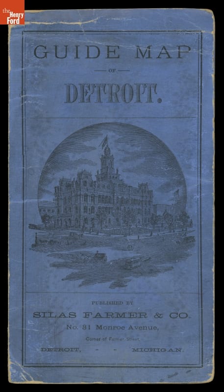
- "Guide Map of Detroit," 1878 -
- 1878
- Collections - Artifact
"Guide Map of Detroit," 1878
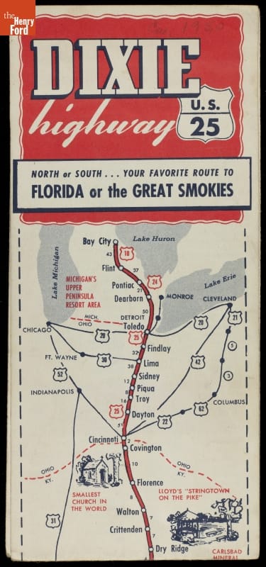
- "Dixie Highway, U.S. 25," circa 1950 - This brochure from about 1950 uses the more familiar trail name for Route 25 from Michigan to Florida -- the Dixie Highway.
- circa 1950
- Collections - Artifact
"Dixie Highway, U.S. 25," circa 1950
This brochure from about 1950 uses the more familiar trail name for Route 25 from Michigan to Florida -- the Dixie Highway.
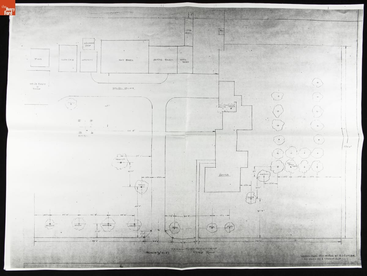
- Layout Map of Ford Road and Greenfield Road, Dearborn, Michigan, 1920-1922 -
- 1920-1922
- Collections - Artifact
Layout Map of Ford Road and Greenfield Road, Dearborn, Michigan, 1920-1922
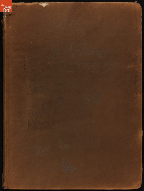
- "In Nature's Laboratory : Commemorating Our Vacation Trip of 1916, August 28th to September 9th" - The Vagabonds -- Henry Ford, Thomas Edison, Harvey Firestone, and John Burroughs -- enjoyed their annual camping trips taken from 1916 to 1924. Burroughs chronicled the group's 1916 journey in the elaborate scrapbook <em>In Nature's Laboratory</em>. Burroughs, Edison, and Firestone traveled through the Adirondack Mountains and Vermont. Ford couldn't make the trip that year.
- 28 August 1916-09 September 1916
- Collections - Artifact
"In Nature's Laboratory : Commemorating Our Vacation Trip of 1916, August 28th to September 9th"
The Vagabonds -- Henry Ford, Thomas Edison, Harvey Firestone, and John Burroughs -- enjoyed their annual camping trips taken from 1916 to 1924. Burroughs chronicled the group's 1916 journey in the elaborate scrapbook In Nature's Laboratory. Burroughs, Edison, and Firestone traveled through the Adirondack Mountains and Vermont. Ford couldn't make the trip that year.
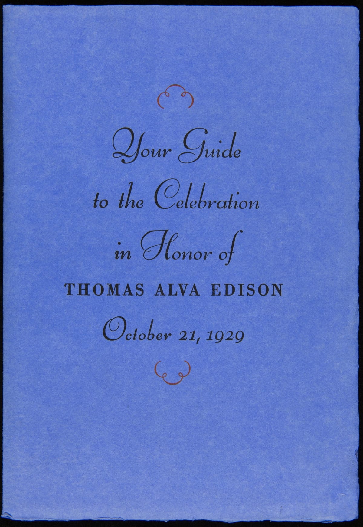
- Your Guide to the Celebration in Honor of Thomas Alva Edison, October 21, 1929 - On October 21, 1929, Henry Ford hosted an event, Light's Golden Jubilee, which celebrated the 50th anniversary of Thomas Edison's invention of a practical incandescent lamp. The event also served as the official dedication of The Edison Institute, Ford's museum complex named in honor of his friend. This detailed guide provided guests with instructions on logistics and a description of the events to be enjoyed during the day-long celebration.
- October 21, 1929
- Collections - Artifact
Your Guide to the Celebration in Honor of Thomas Alva Edison, October 21, 1929
On October 21, 1929, Henry Ford hosted an event, Light's Golden Jubilee, which celebrated the 50th anniversary of Thomas Edison's invention of a practical incandescent lamp. The event also served as the official dedication of The Edison Institute, Ford's museum complex named in honor of his friend. This detailed guide provided guests with instructions on logistics and a description of the events to be enjoyed during the day-long celebration.
- Hallmark "World-Class Teacher" Christmas Ornament, 1992 - Already known for greeting cards, Hallmark introduced a line of Christmas ornaments in 1973. The company's annual release of an increasing array of ornaments revolutionized Christmas decorating, appealing to customers' interest in marking memories and milestones as well as expressing one's personality and unique tastes.

- 1992
- Collections - Artifact
Hallmark "World-Class Teacher" Christmas Ornament, 1992
Already known for greeting cards, Hallmark introduced a line of Christmas ornaments in 1973. The company's annual release of an increasing array of ornaments revolutionized Christmas decorating, appealing to customers' interest in marking memories and milestones as well as expressing one's personality and unique tastes.
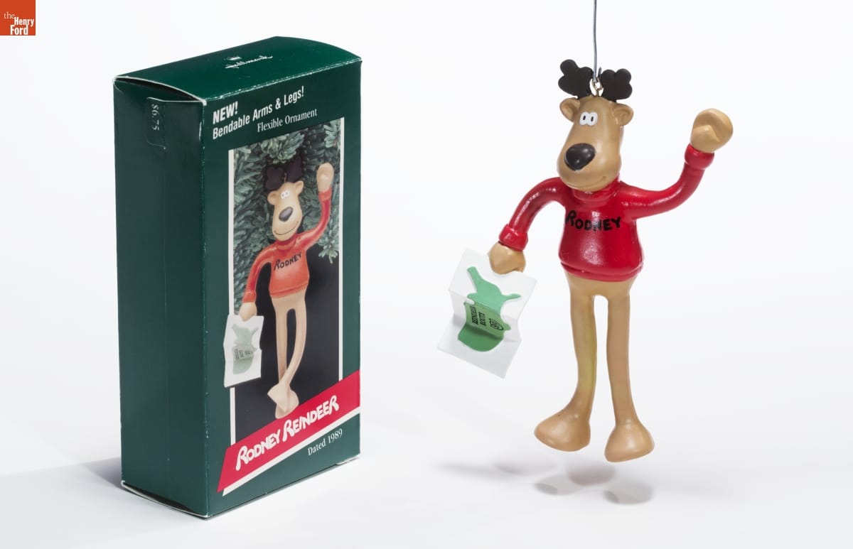
- Hallmark "Rodney Reindeer" Christmas Ornament, 1989 - Already known for greeting cards, Hallmark introduced a line of Christmas ornaments in 1973. The company's annual release of an increasing array of ornaments revolutionized Christmas decorating, appealing to customers' interest in marking memories and milestones as well as expressing one's personality and unique tastes.
- 1989
- Collections - Artifact
Hallmark "Rodney Reindeer" Christmas Ornament, 1989
Already known for greeting cards, Hallmark introduced a line of Christmas ornaments in 1973. The company's annual release of an increasing array of ornaments revolutionized Christmas decorating, appealing to customers' interest in marking memories and milestones as well as expressing one's personality and unique tastes.
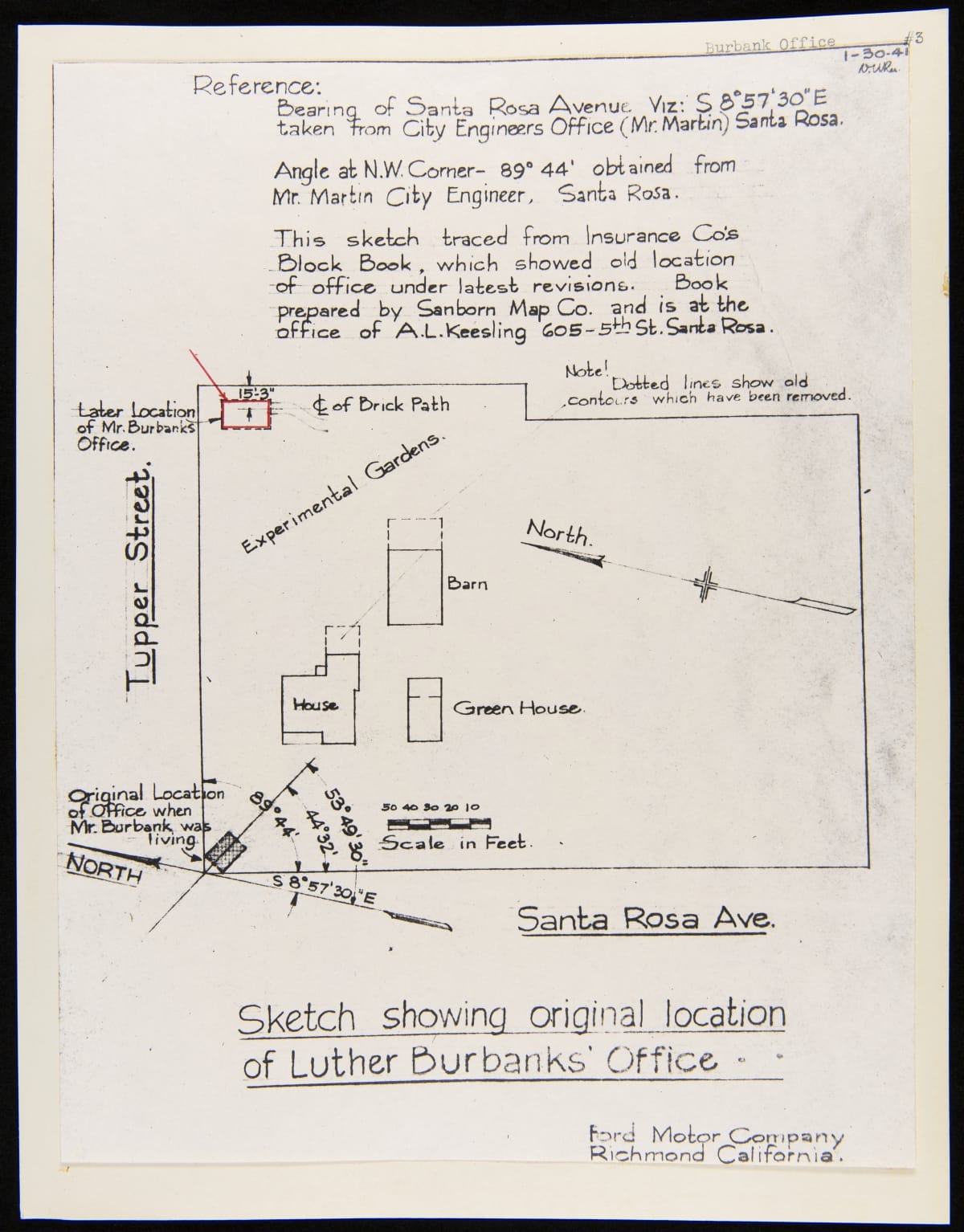
- Sketch Showing Original Location of Luther Burbank Garden Office, Santa Rosa, California, January 30, 1941 - Luther Burbank (1849-1926), a much-heralded American horticulturalist, gained a reputation for selectively breeding more than 800 new fruits, vegetables, flowers, and other plants. He opened a "Bureau of Information" in 1910 to sell seeds and souvenirs. Burbank's widow described it as the "little office" when she offered it to Henry Ford in 1928. This map documents its original locations in Santa Rosa, California.
- January 30, 1941
- Collections - Artifact
Sketch Showing Original Location of Luther Burbank Garden Office, Santa Rosa, California, January 30, 1941
Luther Burbank (1849-1926), a much-heralded American horticulturalist, gained a reputation for selectively breeding more than 800 new fruits, vegetables, flowers, and other plants. He opened a "Bureau of Information" in 1910 to sell seeds and souvenirs. Burbank's widow described it as the "little office" when she offered it to Henry Ford in 1928. This map documents its original locations in Santa Rosa, California.
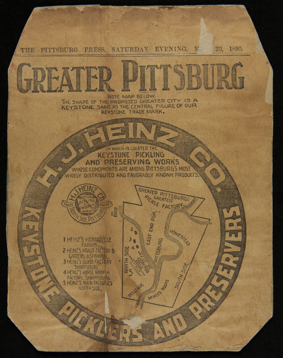
- Newspaper Advertising, "H. J. Heinz Co. Keystone Picklers and Preservers," May 25, 1895 - From very early on in the company's history, the keystone became the symbol of the H.J. Heinz Company. In this newspaper advertisement, a keystone symbol was juxtaposed over a map of the Pittsburgh area showing various Heinz farms and factories.
- May 25, 1895
- Collections - Artifact
Newspaper Advertising, "H. J. Heinz Co. Keystone Picklers and Preservers," May 25, 1895
From very early on in the company's history, the keystone became the symbol of the H.J. Heinz Company. In this newspaper advertisement, a keystone symbol was juxtaposed over a map of the Pittsburgh area showing various Heinz farms and factories.
- Greenfield Village & Henry Ford Museum Informational Brochure, "Handbook for Teachers," 1976 -
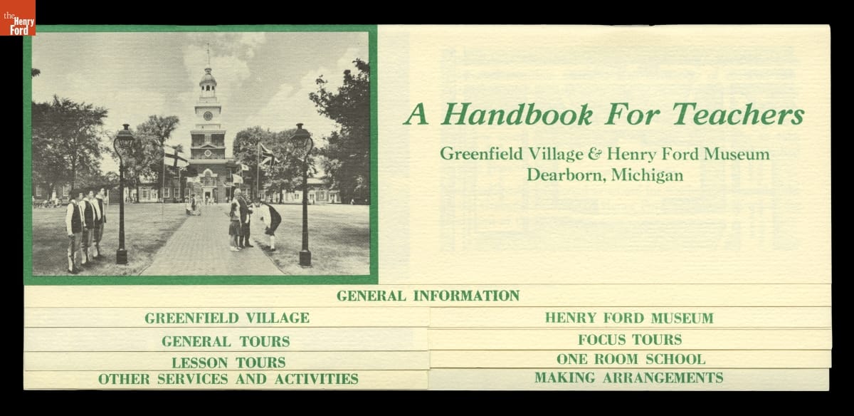
- 1976
- Collections - Artifact
Greenfield Village & Henry Ford Museum Informational Brochure, "Handbook for Teachers," 1976