Search
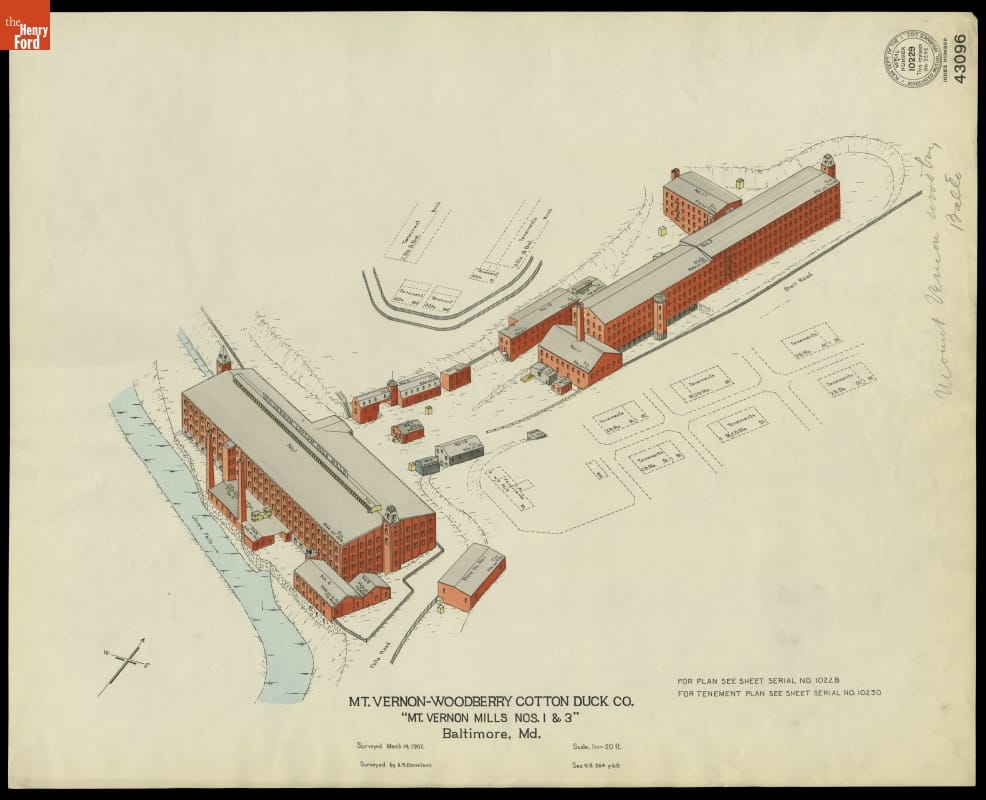
- Fire Insurance Map of the Mt. Vernon-Woodberry Cotton Duck Co., Baltimore, Maryland, Surveyed March 14, 1902 - Fire insurance maps provided information to insurance companies about potential risks to homes, businesses, and factories. These maps -- with their easily identifiable symbols and color-coding -- depicted structural features, types of construction, and locations of fire hazards. Armed with this information, insurance underwriters could propose reasonable rates and offer protection against possible catastrophic financial loss in the event of a fire.
- March 14, 1902
- Collections - Artifact
Fire Insurance Map of the Mt. Vernon-Woodberry Cotton Duck Co., Baltimore, Maryland, Surveyed March 14, 1902
Fire insurance maps provided information to insurance companies about potential risks to homes, businesses, and factories. These maps -- with their easily identifiable symbols and color-coding -- depicted structural features, types of construction, and locations of fire hazards. Armed with this information, insurance underwriters could propose reasonable rates and offer protection against possible catastrophic financial loss in the event of a fire.
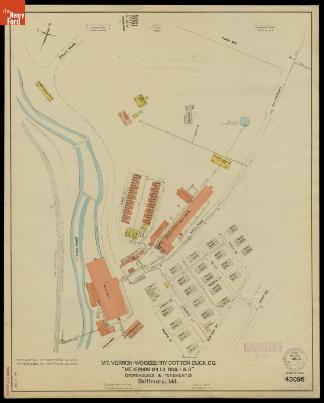
- Fire Insurance Map of the Mt. Vernon-Woodberry Cotton Duck Co., Baltimore, Maryland, Surveyed March 14, 1912 - Fire insurance maps provided information to insurance companies about potential risks to homes, businesses, and factories. These maps -- with their easily identifiable symbols and color-coding -- depicted structural features, types of construction, and locations of fire hazards. Armed with this information, insurance underwriters could propose reasonable rates and offer protection against possible catastrophic financial loss in the event of a fire.
- March 14, 1912
- Collections - Artifact
Fire Insurance Map of the Mt. Vernon-Woodberry Cotton Duck Co., Baltimore, Maryland, Surveyed March 14, 1912
Fire insurance maps provided information to insurance companies about potential risks to homes, businesses, and factories. These maps -- with their easily identifiable symbols and color-coding -- depicted structural features, types of construction, and locations of fire hazards. Armed with this information, insurance underwriters could propose reasonable rates and offer protection against possible catastrophic financial loss in the event of a fire.
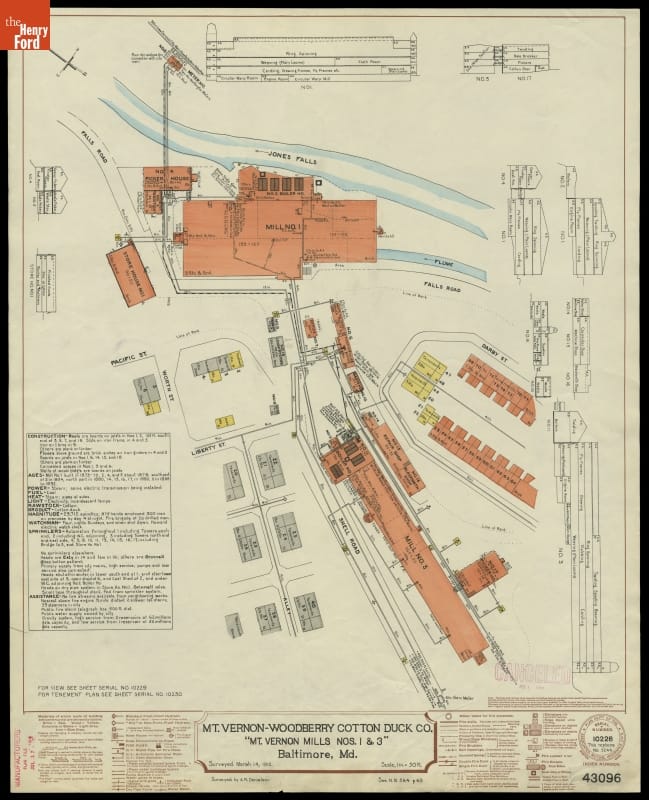
- Fire Insurance Map of the Mt. Vernon-Woodberry Cotton Duck Co., Baltimore, Maryland, Surveyed March 14, 1912 - Fire insurance maps provided information to insurance companies about potential risks to homes, businesses, and factories. These maps -- with their easily identifiable symbols and color-coding -- depicted structural features, types of construction, and locations of fire hazards. Armed with this information, insurance underwriters could propose reasonable rates and offer protection against possible catastrophic financial loss in the event of a fire.
- March 14, 1912
- Collections - Artifact
Fire Insurance Map of the Mt. Vernon-Woodberry Cotton Duck Co., Baltimore, Maryland, Surveyed March 14, 1912
Fire insurance maps provided information to insurance companies about potential risks to homes, businesses, and factories. These maps -- with their easily identifiable symbols and color-coding -- depicted structural features, types of construction, and locations of fire hazards. Armed with this information, insurance underwriters could propose reasonable rates and offer protection against possible catastrophic financial loss in the event of a fire.