Search
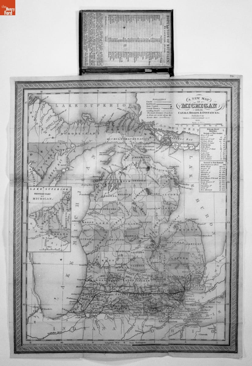
- Mitchell's Map of Michigan, 1850 - This map shows Michigan in 1850, some 13 years after it achieved statehood. Cities were still largely confined to the southern Lower Peninsula. The map also includes major rivers and the state's emerging railroad network. The latter was dominated by the Michigan Central Railroad, running west from Detroit toward Chicago via Ann Arbor, Jackson, Battle Creek, and Kalamazoo.
- 1850
- Collections - Artifact
Mitchell's Map of Michigan, 1850
This map shows Michigan in 1850, some 13 years after it achieved statehood. Cities were still largely confined to the southern Lower Peninsula. The map also includes major rivers and the state's emerging railroad network. The latter was dominated by the Michigan Central Railroad, running west from Detroit toward Chicago via Ann Arbor, Jackson, Battle Creek, and Kalamazoo.