Search
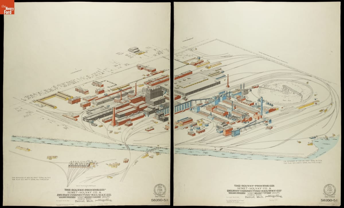
- Fire Insurance Map of the Semet-Solvay Co. & Semet Groups Chemical Works, Detroit, Michigan, February 21, 1925 - Fire insurance maps provided information to insurance companies about potential risks to homes, businesses, and factories. These maps -- with their easily identifiable symbols and color-coding -- depicted structural features, types of construction, and locations of fire hazards. Armed with this information, insurance underwriters could propose reasonable rates and offer protection against possible catastrophic financial loss in the event of a fire.
- February 21, 1925
- Collections - Artifact
Fire Insurance Map of the Semet-Solvay Co. & Semet Groups Chemical Works, Detroit, Michigan, February 21, 1925
Fire insurance maps provided information to insurance companies about potential risks to homes, businesses, and factories. These maps -- with their easily identifiable symbols and color-coding -- depicted structural features, types of construction, and locations of fire hazards. Armed with this information, insurance underwriters could propose reasonable rates and offer protection against possible catastrophic financial loss in the event of a fire.
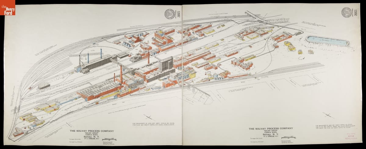
- Fire Insurance Map of Solvay Process Company Chemical Works, Solvay, New York, Surveyed December 15, 1932 - Fire insurance maps provided information to insurance companies about potential risks to homes, businesses, and factories. These maps -- with their easily identifiable symbols and color-coding -- depicted structural features, types of construction, and locations of fire hazards. Armed with this information, insurance underwriters could propose reasonable rates and offer protection against possible catastrophic financial loss in the event of a fire.
- December 13, 1932
- Collections - Artifact
Fire Insurance Map of Solvay Process Company Chemical Works, Solvay, New York, Surveyed December 15, 1932
Fire insurance maps provided information to insurance companies about potential risks to homes, businesses, and factories. These maps -- with their easily identifiable symbols and color-coding -- depicted structural features, types of construction, and locations of fire hazards. Armed with this information, insurance underwriters could propose reasonable rates and offer protection against possible catastrophic financial loss in the event of a fire.
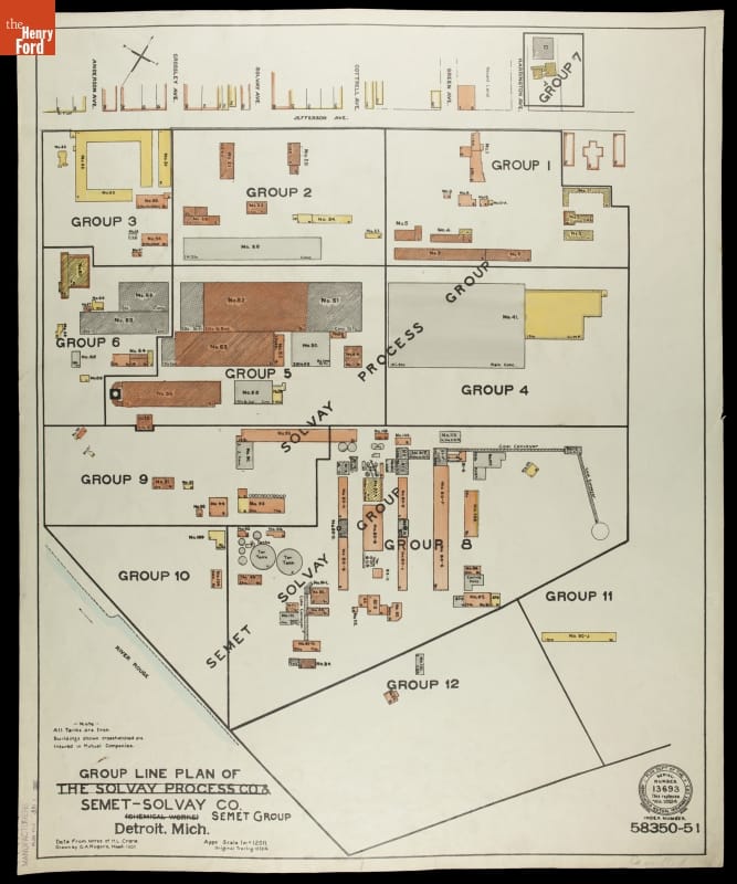
- Fire Insurance Map of the Solvay Process Co. & Semet-Solvay Co., Detroit, Michigan, March 1920 - Fire insurance maps provided information to insurance companies about potential risks to homes, businesses, and factories. These maps -- with their easily identifiable symbols and color-coding -- depicted structural features, types of construction, and locations of fire hazards. Armed with this information, insurance underwriters could propose reasonable rates and offer protection against possible catastrophic financial loss in the event of a fire.
- March 01, 1920
- Collections - Artifact
Fire Insurance Map of the Solvay Process Co. & Semet-Solvay Co., Detroit, Michigan, March 1920
Fire insurance maps provided information to insurance companies about potential risks to homes, businesses, and factories. These maps -- with their easily identifiable symbols and color-coding -- depicted structural features, types of construction, and locations of fire hazards. Armed with this information, insurance underwriters could propose reasonable rates and offer protection against possible catastrophic financial loss in the event of a fire.