Search
- Mitchell's Map of Michigan, 1835 - This map shows Michigan Territory in 1835, the year it began its campaign for statehood. The process was delayed for two years by a disagreement with Ohio over an area of land referred to as the Toledo Strip. Congress settled the dispute by awarding the strip to Ohio and giving Michigan the western portion of the Upper Peninsula.
- 1835
- Collections - Artifact
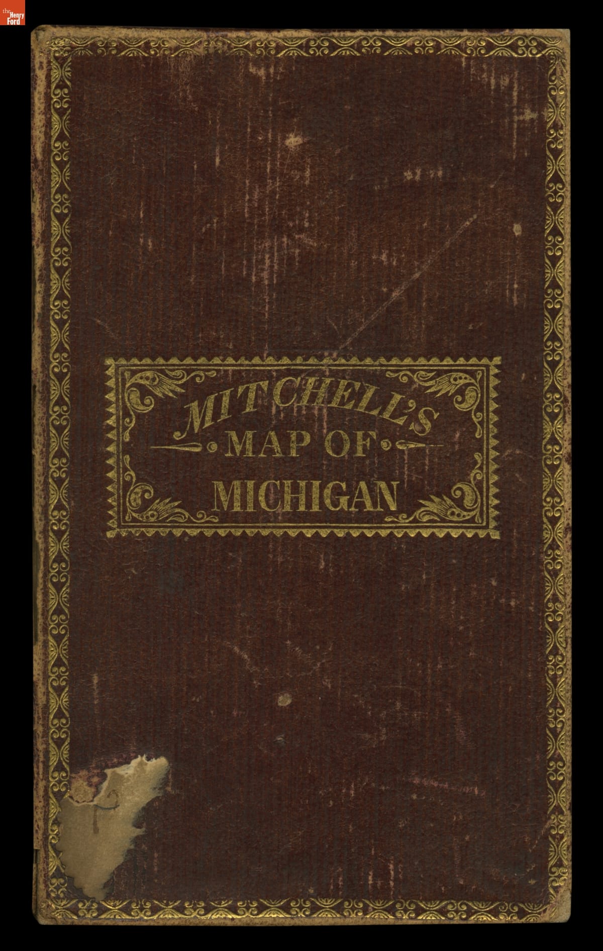
Mitchell's Map of Michigan, 1835
This map shows Michigan Territory in 1835, the year it began its campaign for statehood. The process was delayed for two years by a disagreement with Ohio over an area of land referred to as the Toledo Strip. Congress settled the dispute by awarding the strip to Ohio and giving Michigan the western portion of the Upper Peninsula.
- Letter from William Woodbridge to Ramsay Crooks, February 17, 1822 -
- February 17, 1822
- Collections - Artifact
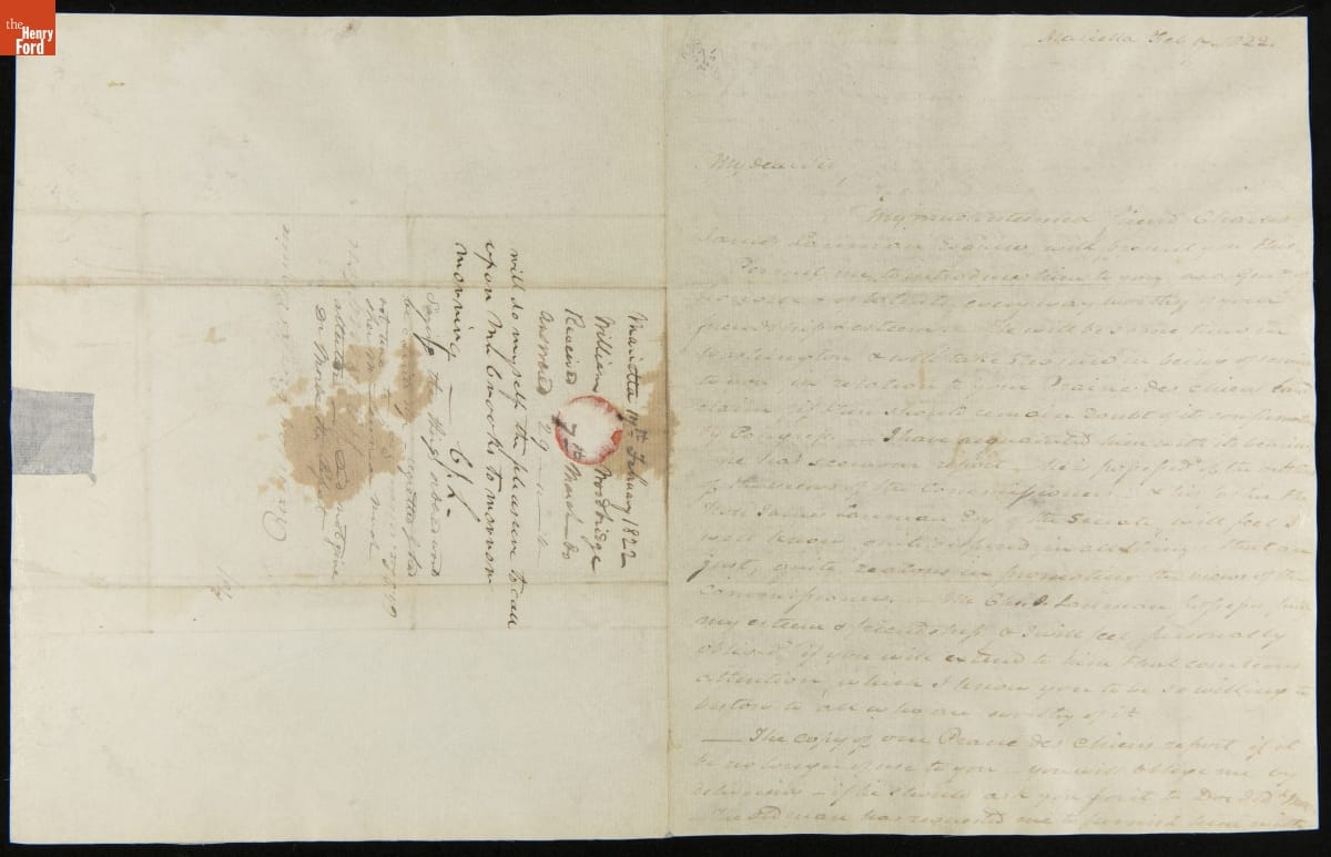
Letter from William Woodbridge to Ramsay Crooks, February 17, 1822
- Farmer's Map of Michigan, 1831 - This map shows Michigan Territory in 1831, six years before it became the 26th state. Michigan's population growth had been slow until the opening of the Erie Canal in 1825. The canal connected the Great Lakes with the Hudson River, greatly easing the movement of people and goods between Michigan and the big cities of the northeastern United States.
- 1831
- Collections - Artifact
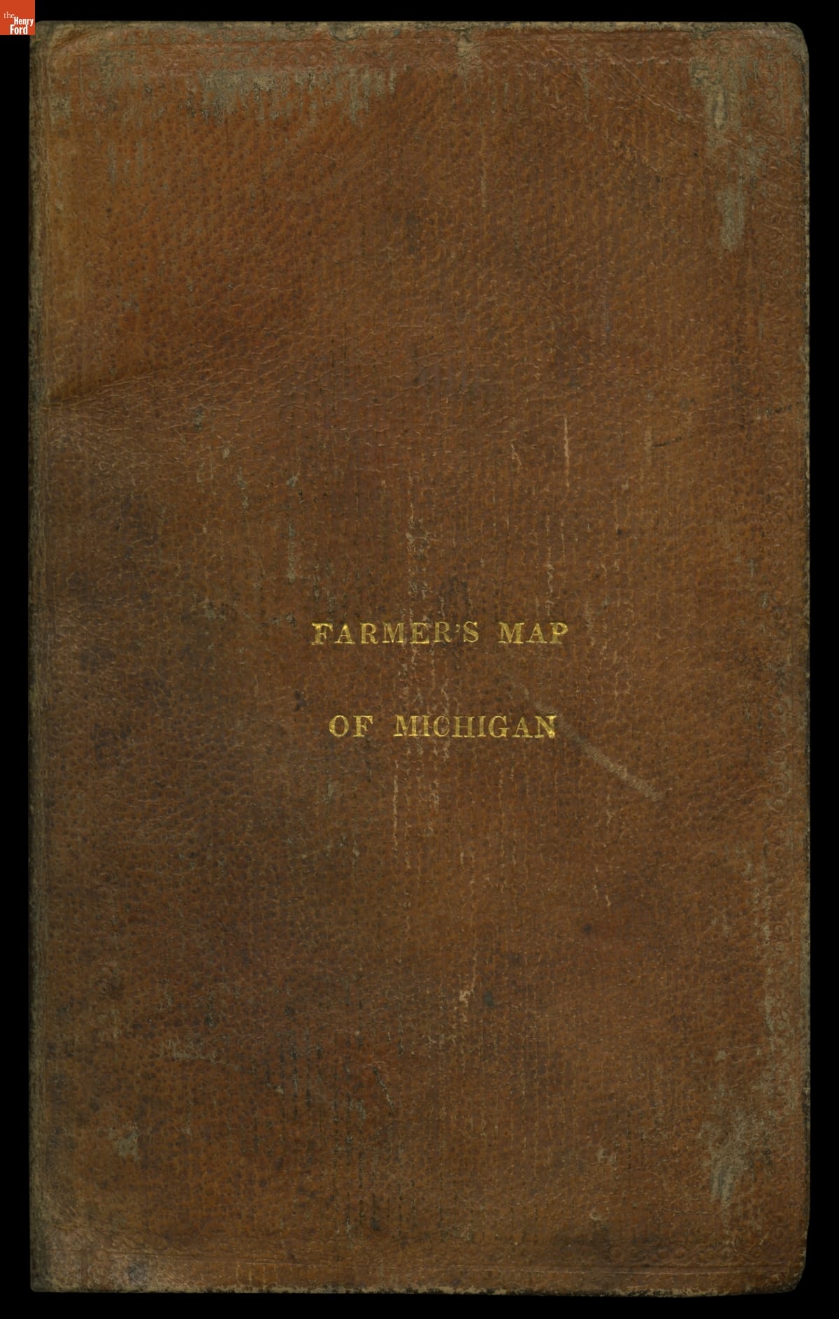
Farmer's Map of Michigan, 1831
This map shows Michigan Territory in 1831, six years before it became the 26th state. Michigan's population growth had been slow until the opening of the Erie Canal in 1825. The canal connected the Great Lakes with the Hudson River, greatly easing the movement of people and goods between Michigan and the big cities of the northeastern United States.
- Farmer's Map of Michigan: Exhibiting the Sections, 1837 - This map shows Michigan in 1837, the year the territory achieved statehood. It presents the southern portion of the Lower Peninsula -- where most cities and towns were located at the time -- in detail, while northern areas including the Upper Peninsula are shown in insets. The important area around the Straits of Mackinac has its own inset as well.
- 1837
- Collections - Artifact
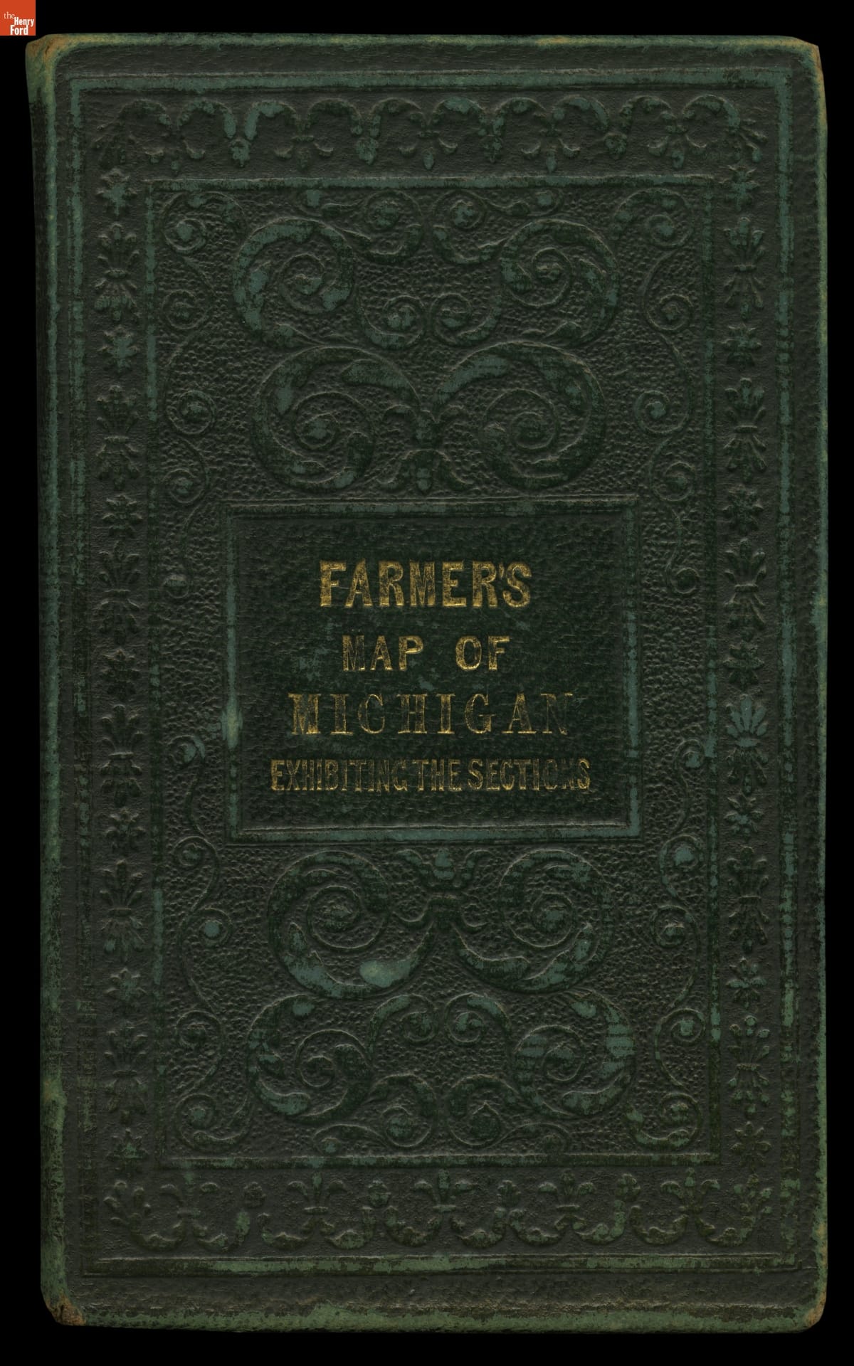
Farmer's Map of Michigan: Exhibiting the Sections, 1837
This map shows Michigan in 1837, the year the territory achieved statehood. It presents the southern portion of the Lower Peninsula -- where most cities and towns were located at the time -- in detail, while northern areas including the Upper Peninsula are shown in insets. The important area around the Straits of Mackinac has its own inset as well.
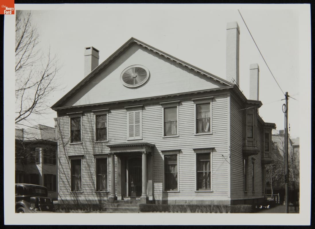
- Noah Webster House at its Original Site, New Haven, Connecticut, March 31, 1934 - This is textbook pioneer and spelling reformer Noah Webster's home on its original site in New Haven, Connecticut. Henry Ford admired Webster and recognized his house as an important piece of American history. Ford had the building moved to Greenfield Village - his historical outdoor museum in Dearborn, Michigan. This view documents architectural details, including second floor bay windows not moved with the house.
- March 31, 1934
- Collections - Artifact
Noah Webster House at its Original Site, New Haven, Connecticut, March 31, 1934
This is textbook pioneer and spelling reformer Noah Webster's home on its original site in New Haven, Connecticut. Henry Ford admired Webster and recognized his house as an important piece of American history. Ford had the building moved to Greenfield Village - his historical outdoor museum in Dearborn, Michigan. This view documents architectural details, including second floor bay windows not moved with the house.
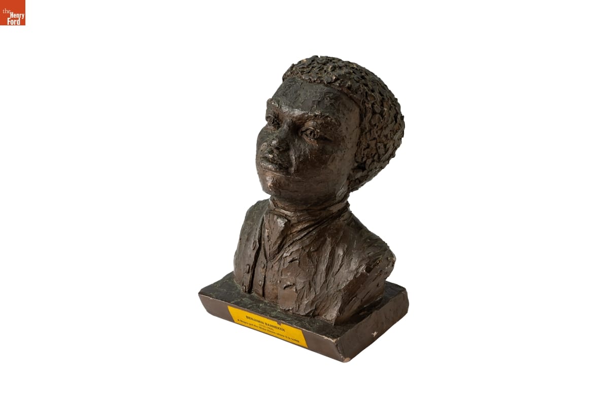
- Plaster Bust of Benjamin Banneker - Benjamin Banneker (1731-1806) was born to a free Black mother and a formerly enslaved father. Despite having little to no formal education, he wrote several almanacs based on his own astronomical calculations, constructed a striking clock based on his own design, and corresponded with Thomas Jefferson about abolition. Banneker also worked as a surveyor, assisting in setting the boundaries for the District of Columbia.
- Collections - Artifact
Plaster Bust of Benjamin Banneker
Benjamin Banneker (1731-1806) was born to a free Black mother and a formerly enslaved father. Despite having little to no formal education, he wrote several almanacs based on his own astronomical calculations, constructed a striking clock based on his own design, and corresponded with Thomas Jefferson about abolition. Banneker also worked as a surveyor, assisting in setting the boundaries for the District of Columbia.
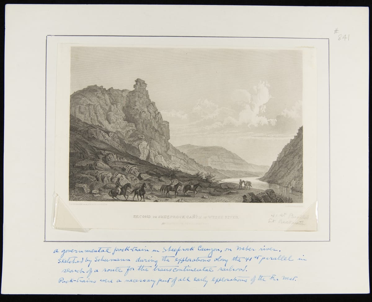
- Second or Sheeprock Canon of Weber River. April 6th at 1pm. View Looking East - The Pacific Railroad Surveys, authorized by Congress in 1853, studied parts of six potential railroad routes between the Mississippi River and the Pacific Ocean. This illustration, of Utah's Weber River Canyon, was made while surveying the so-called 41st Parallel Route, which roughly followed that circle of latitude. Ultimately, this route was used by the First Transcontinental Railroad, completed in 1869.
- April 06, 1854
- Collections - Artifact
Second or Sheeprock Canon of Weber River. April 6th at 1pm. View Looking East
The Pacific Railroad Surveys, authorized by Congress in 1853, studied parts of six potential railroad routes between the Mississippi River and the Pacific Ocean. This illustration, of Utah's Weber River Canyon, was made while surveying the so-called 41st Parallel Route, which roughly followed that circle of latitude. Ultimately, this route was used by the First Transcontinental Railroad, completed in 1869.
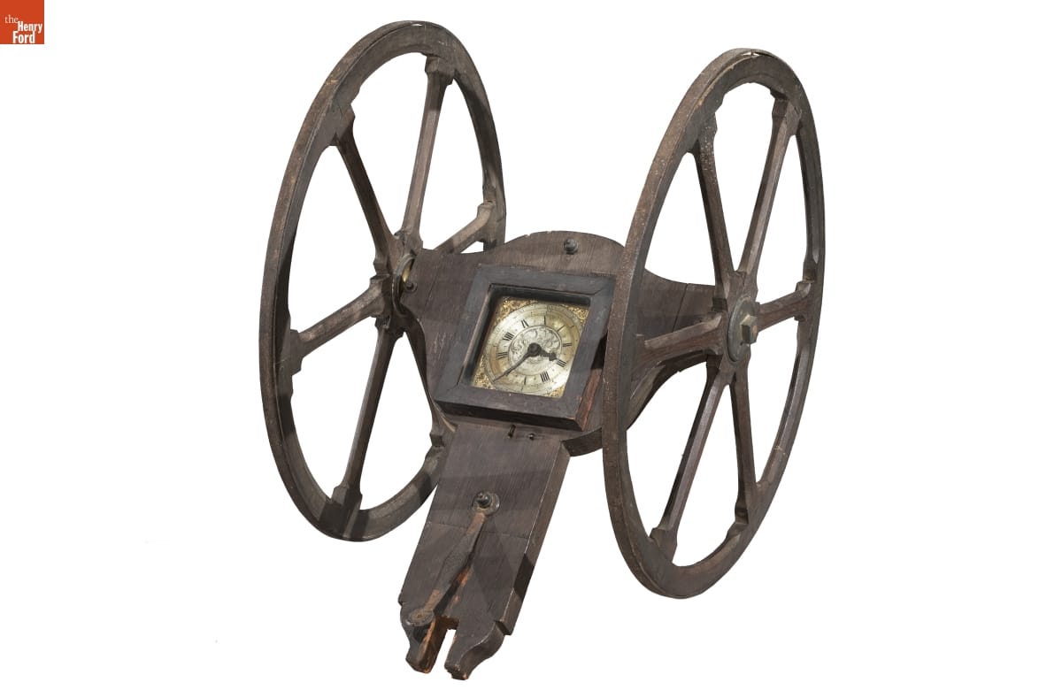
- Cyclometer, circa 1725 -
- circa 1725
- Collections - Artifact
Cyclometer, circa 1725
- "Yerkes Pond Survey, Northville, Michigan," 1926 -
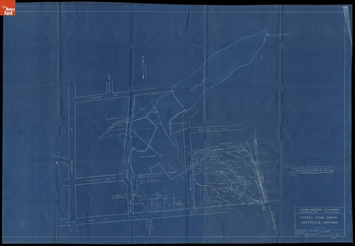
- February 11, 1926
- Collections - Artifact
"Yerkes Pond Survey, Northville, Michigan," 1926
- Correspondence regarding Noah Webster Home and the Historic American Buildings Survey, September-October 1936 - Henry Ford admired Noah Webster and recognized his house as an important piece of American history. In 1936, Yale University--which owned the New Haven, Connecticut, house--planned to tear down the structure. Ford purchased it instead and had it moved to Greenfield Village--his historical outdoor museum in Dearborn, Michigan. He also gathered other available documentation on the house.
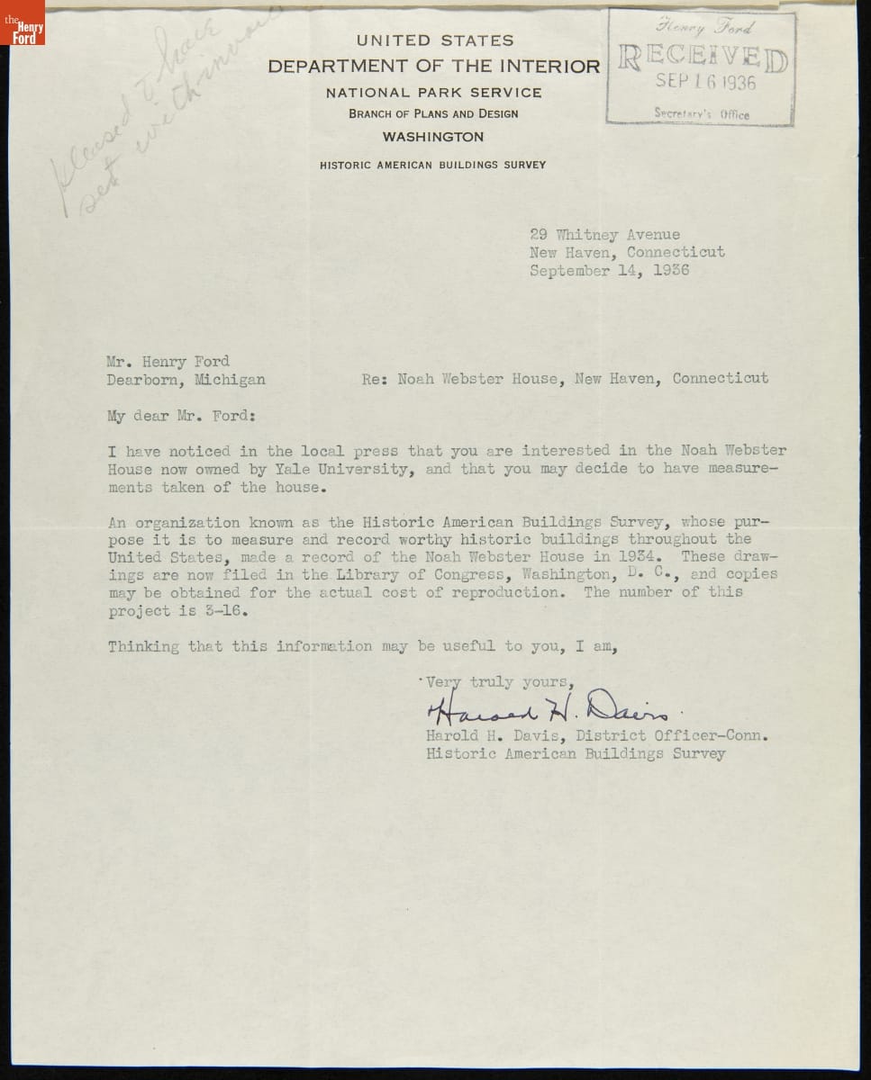
- 14 September 1936-October 1936
- Collections - Artifact
Correspondence regarding Noah Webster Home and the Historic American Buildings Survey, September-October 1936
Henry Ford admired Noah Webster and recognized his house as an important piece of American history. In 1936, Yale University--which owned the New Haven, Connecticut, house--planned to tear down the structure. Ford purchased it instead and had it moved to Greenfield Village--his historical outdoor museum in Dearborn, Michigan. He also gathered other available documentation on the house.