Search
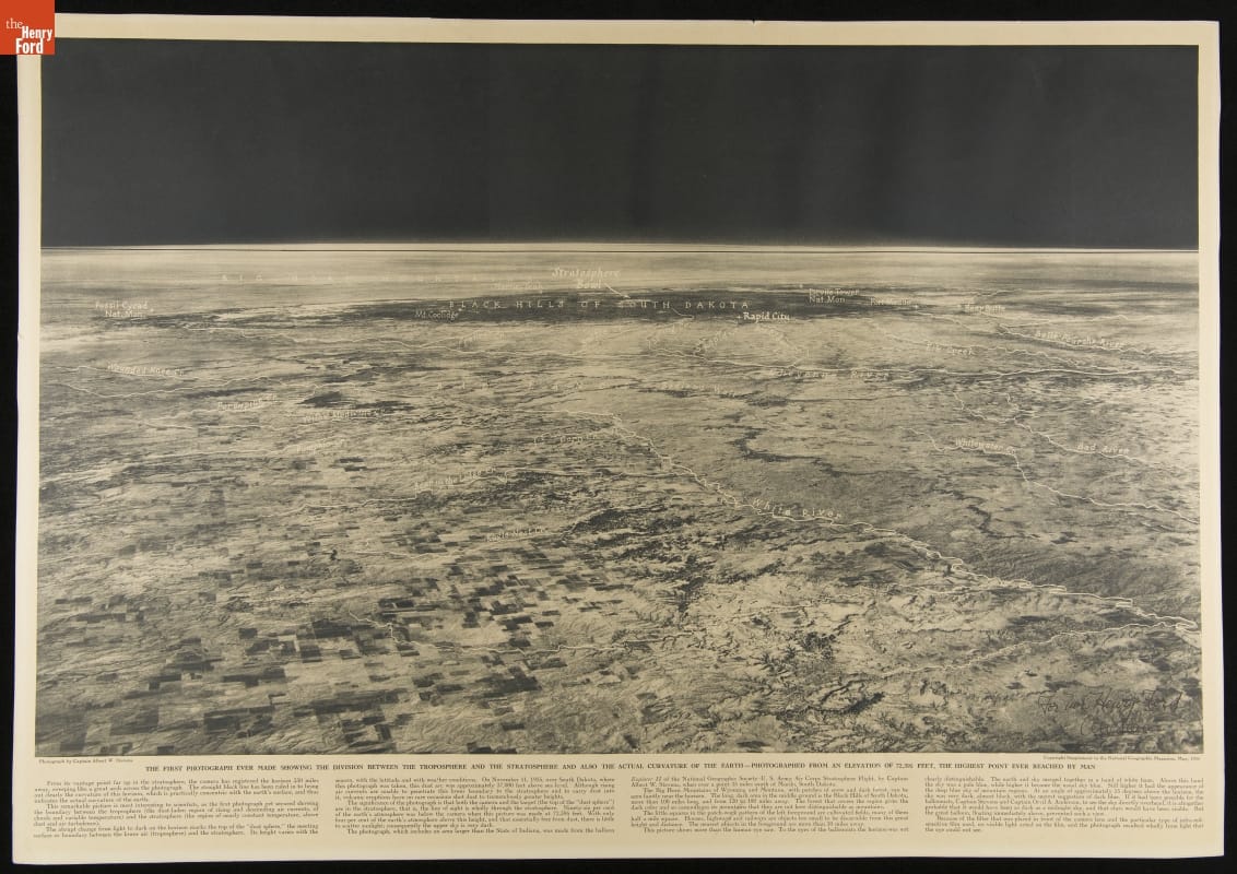
- Photograph Showing the Troposphere, the Stratosphere and the Curvature of the Earth, November 1935 - Taken from a balloon at the record-setting altitude of 72,395 feet, this was the first photograph depicting the division between the lowest two layers of Earth's atmosphere. The photographer, U.S. Army Air Corps Captain and aerial photography pioneer Albert W. Stevens, also captured the curvature of the Earth, the Bighorn Mountains of Montana and Wyoming, and the Black Hills of South Dakota.
- November 11, 1935
- Collections - Artifact
Photograph Showing the Troposphere, the Stratosphere and the Curvature of the Earth, November 1935
Taken from a balloon at the record-setting altitude of 72,395 feet, this was the first photograph depicting the division between the lowest two layers of Earth's atmosphere. The photographer, U.S. Army Air Corps Captain and aerial photography pioneer Albert W. Stevens, also captured the curvature of the Earth, the Bighorn Mountains of Montana and Wyoming, and the Black Hills of South Dakota.