Search
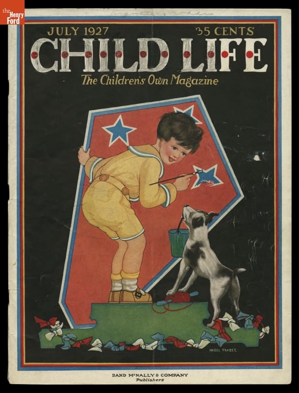
- "Child Life" Magazine for July 1927 -
- July 01, 1927
- Collections - Artifact
"Child Life" Magazine for July 1927
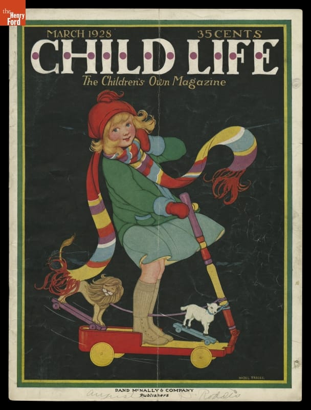
- "Child Life" Magazine for March 1928 -
- March 01, 1928
- Collections - Artifact
"Child Life" Magazine for March 1928
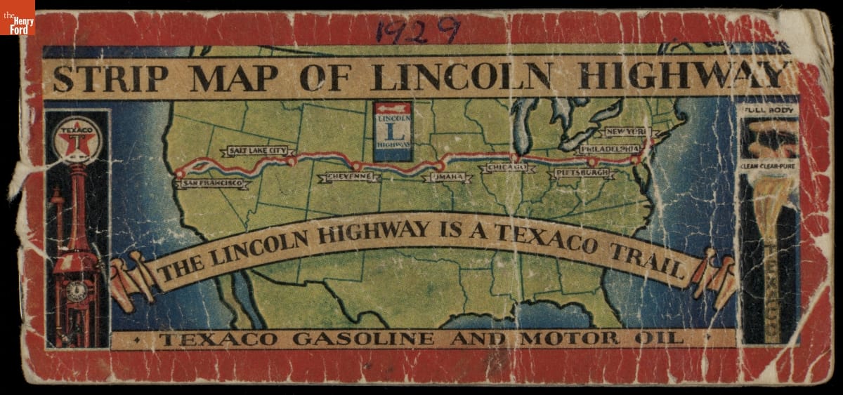
- "Strip Map of Lincoln Highway," 1929 - The Lincoln Highway, dedicated in 1913, ran from New York City to San Francisco, California. It was America's first cross-country highway. Using limited funds, it was mostly a patched-together series of existing dirt roads. But the publicity it generated raised public awareness of the need for better roads. Texaco included travel tips with this pocket map they published in 1929.
- 1929
- Collections - Artifact
"Strip Map of Lincoln Highway," 1929
The Lincoln Highway, dedicated in 1913, ran from New York City to San Francisco, California. It was America's first cross-country highway. Using limited funds, it was mostly a patched-together series of existing dirt roads. But the publicity it generated raised public awareness of the need for better roads. Texaco included travel tips with this pocket map they published in 1929.
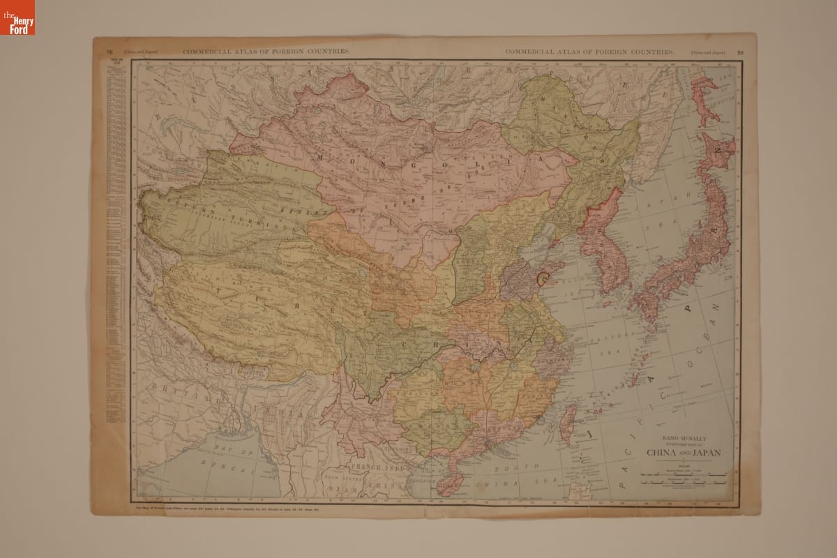
- "Rand McNally Standard Map of China and Japan," 1930-1932 - Ford Motor Company operated sales and service branches in cities around the world. The company considered building an assembly plant in Shanghai, China. This map was collected during the study. Ford decided against the idea when it learned that Chinese law required the property to be owned by a citizen of China.
- 1930-1932
- Collections - Artifact
"Rand McNally Standard Map of China and Japan," 1930-1932
Ford Motor Company operated sales and service branches in cities around the world. The company considered building an assembly plant in Shanghai, China. This map was collected during the study. Ford decided against the idea when it learned that Chinese law required the property to be owned by a citizen of China.
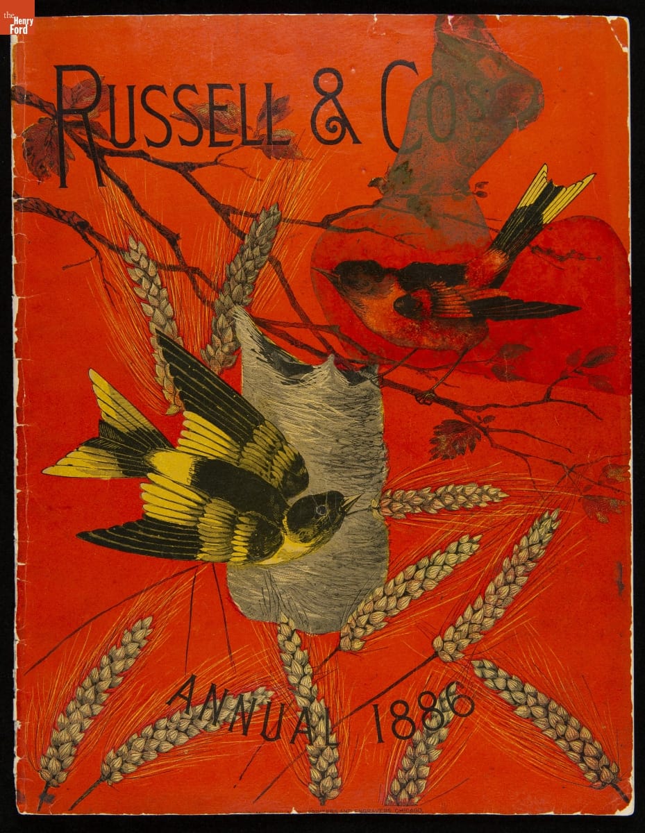
- Russell & Co. Trade Catalog, 1886 - As farmers mechanized barn and farmyard work in the nineteenth century, they began to use stationary power sources. These included portable steam engines and devices that converted animals' movement to drive a variety of agricultural machines. Enterprising manufacturers, like Ohio-based Russell & Co., specialized in producing and selling both power sources and the machines they were designed to run.
- 1886
- Collections - Artifact
Russell & Co. Trade Catalog, 1886
As farmers mechanized barn and farmyard work in the nineteenth century, they began to use stationary power sources. These included portable steam engines and devices that converted animals' movement to drive a variety of agricultural machines. Enterprising manufacturers, like Ohio-based Russell & Co., specialized in producing and selling both power sources and the machines they were designed to run.
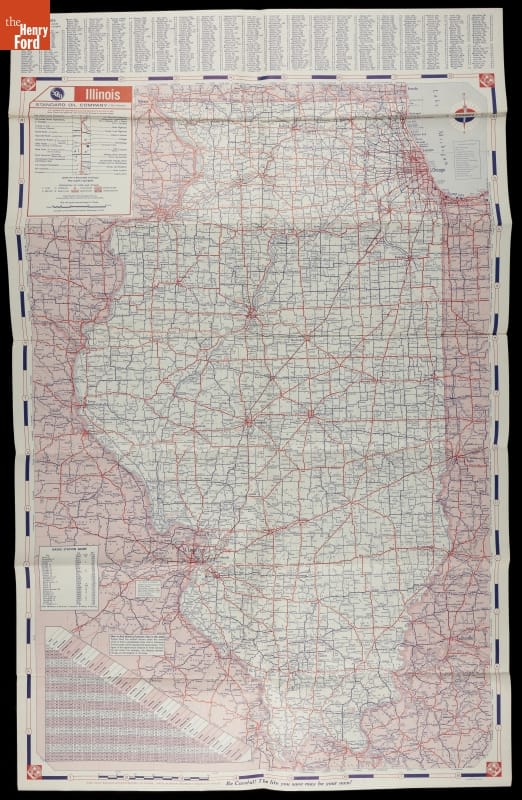
- Illinois Road Map, circa 1955 - Along with the regular automobile service provided by gasoline stations, travelers during the early and mid-20th century could usually find a free road map. Standard Oil supplied this map of Illinois to motorists at their stations.
- circa 1955
- Collections - Artifact
Illinois Road Map, circa 1955
Along with the regular automobile service provided by gasoline stations, travelers during the early and mid-20th century could usually find a free road map. Standard Oil supplied this map of Illinois to motorists at their stations.
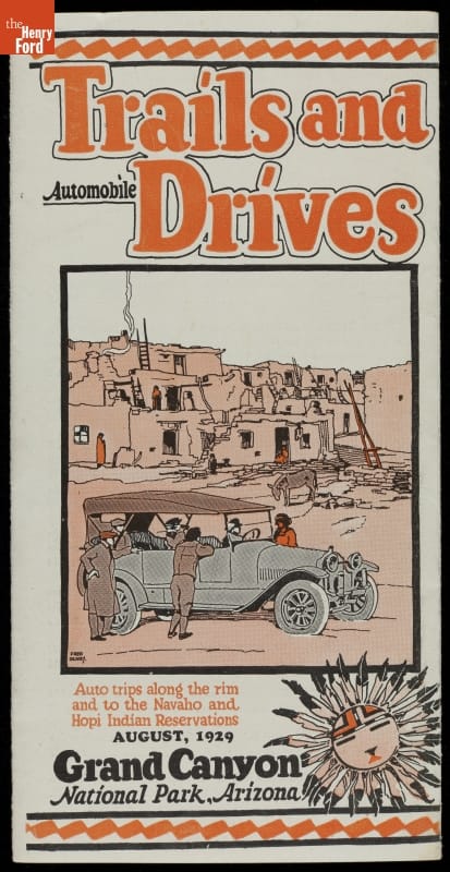
- "Trails and Automobile Drives, Grand Canyon National Park, Arizona," August 1929 -
- August 01, 1929
- Collections - Artifact
"Trails and Automobile Drives, Grand Canyon National Park, Arizona," August 1929
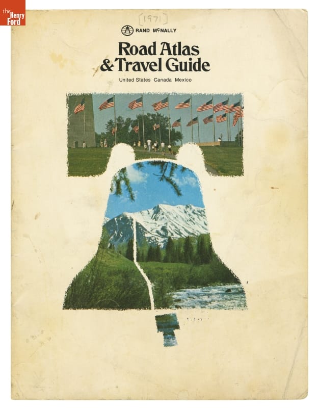
- Rand McNally Road Atlas & Travel Guide for United States, Canada, and Mexico, 1971 - The Interstate Highway System is the largest road-building project ever undertaken by any nation. First authorized in 1956, the system was still under construction when Rand McNally published this road atlas in 1971. The atlas described the interstates as "The Road of the Future." But, for much of America, the future had already arrived with trucks hauling goods, and families taking more long-distance vacations.
- 1971
- Collections - Artifact
Rand McNally Road Atlas & Travel Guide for United States, Canada, and Mexico, 1971
The Interstate Highway System is the largest road-building project ever undertaken by any nation. First authorized in 1956, the system was still under construction when Rand McNally published this road atlas in 1971. The atlas described the interstates as "The Road of the Future." But, for much of America, the future had already arrived with trucks hauling goods, and families taking more long-distance vacations.
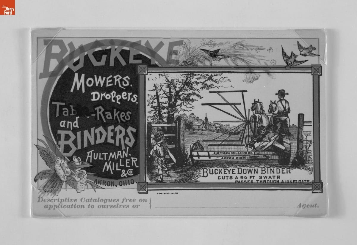
- Trade Card for the Buckeye Down Binder, 1870-1900 - In the last third of the nineteenth century, an unprecedented variety of consumer goods and services flooded the American market. Advertisers, armed with new methods of color printing, bombarded potential customers with trade cards. Americans enjoyed and often saved the vibrant little advertisements found in product packages or distributed by local merchants. Many survive as historical records of commercialism in the United States.
- 1870-1900
- Collections - Artifact
Trade Card for the Buckeye Down Binder, 1870-1900
In the last third of the nineteenth century, an unprecedented variety of consumer goods and services flooded the American market. Advertisers, armed with new methods of color printing, bombarded potential customers with trade cards. Americans enjoyed and often saved the vibrant little advertisements found in product packages or distributed by local merchants. Many survive as historical records of commercialism in the United States.
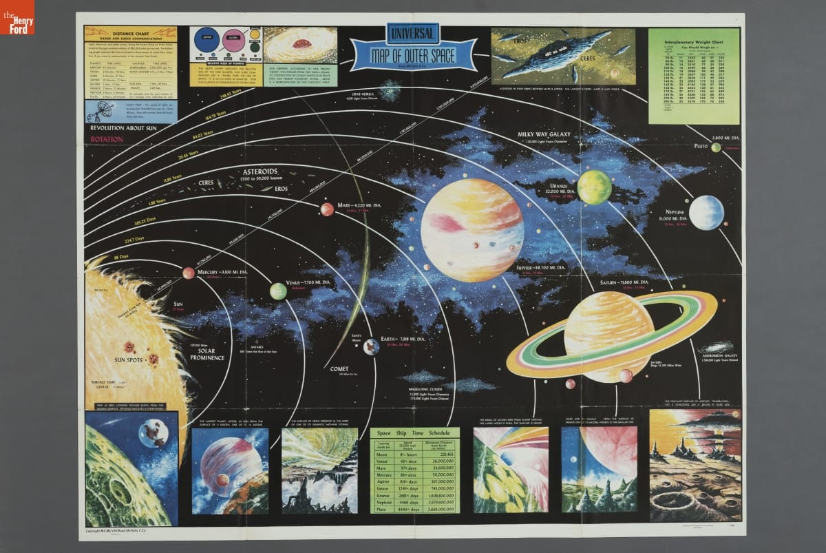
- Solar System Poster, "Universal Map of Outer Space," 1965 - Humans have long been interested in space -- observing the night skies and pondering the movement of the Sun, Moon, and stars. Many Americans viewed outer space through a fantastical and futuristic lens until the launch of a Soviet satellite in 1957. This space map from the early years of the Space Race depicts a more realistic view of the solar system and space exploration.
- 1965
- Collections - Artifact
Solar System Poster, "Universal Map of Outer Space," 1965
Humans have long been interested in space -- observing the night skies and pondering the movement of the Sun, Moon, and stars. Many Americans viewed outer space through a fantastical and futuristic lens until the launch of a Soviet satellite in 1957. This space map from the early years of the Space Race depicts a more realistic view of the solar system and space exploration.