Search
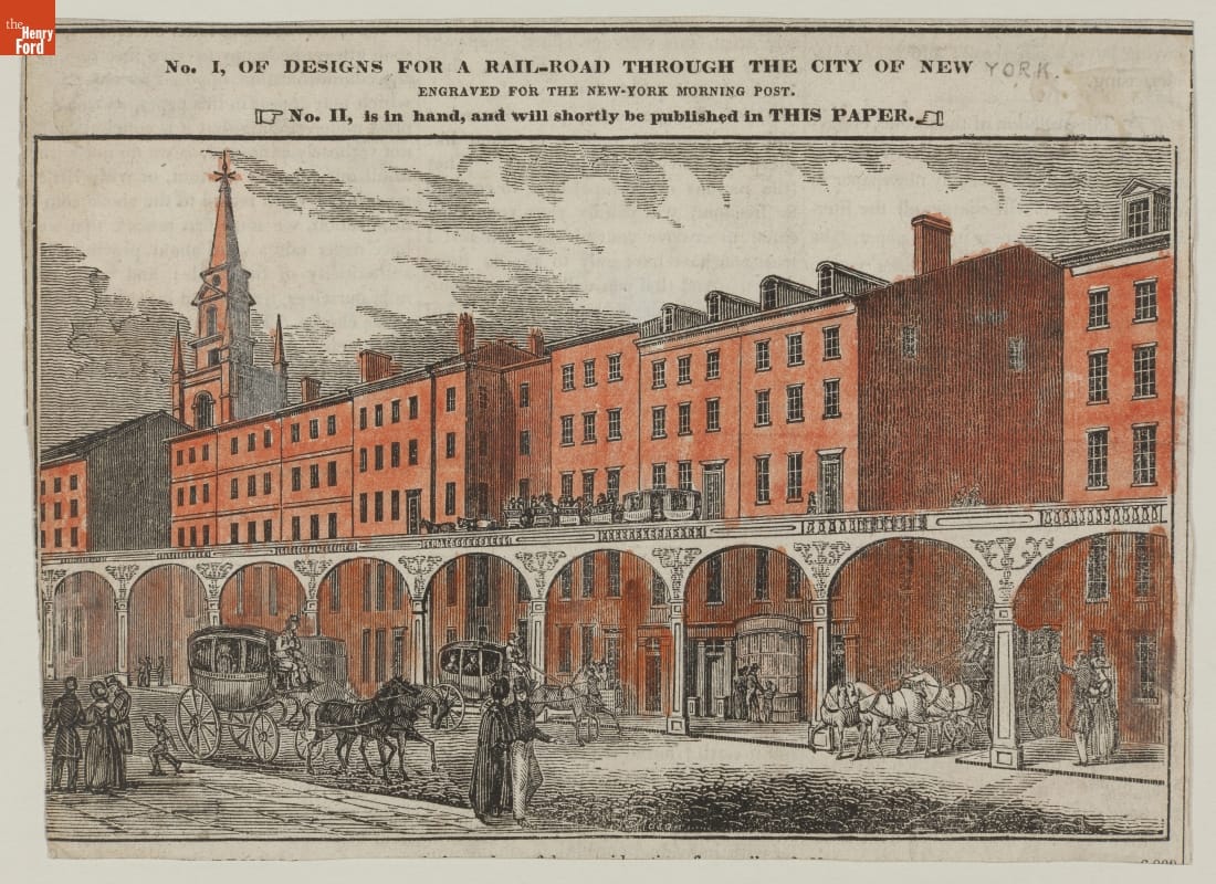
- Wood Engraving, Design for an Elevated Horse-Drawn Railway in New York, circa 1842 - The key to turning mass transit into rapid transit was in removing it from busy streets. One alternative was to build elevated structures that carried streetcars over city traffic. New York City, with its limited land and boundless population, developed a network of elevated lines that covered the length of Manhattan. Other cities, notably Chicago, adopted the technology too.
- circa 1842
- Collections - Artifact
Wood Engraving, Design for an Elevated Horse-Drawn Railway in New York, circa 1842
The key to turning mass transit into rapid transit was in removing it from busy streets. One alternative was to build elevated structures that carried streetcars over city traffic. New York City, with its limited land and boundless population, developed a network of elevated lines that covered the length of Manhattan. Other cities, notably Chicago, adopted the technology too.
- Elevated Railroad at Cooper Union and 4th Avenue, New York, New York, circa 1900 - For nearly thirty years, 1895 to 1924, the Detroit Publishing Company was one of the major image publishers in the world. The company had a wide-ranging stock of original photographs, including many scenes from across North America. Here, trains run on an elevated railway above a commercial New York City street.

- circa 1900
- Collections - Artifact
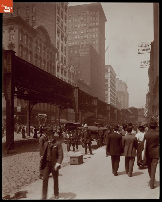
Elevated Railroad at Cooper Union and 4th Avenue, New York, New York, circa 1900
For nearly thirty years, 1895 to 1924, the Detroit Publishing Company was one of the major image publishers in the world. The company had a wide-ranging stock of original photographs, including many scenes from across North America. Here, trains run on an elevated railway above a commercial New York City street.
- Sightseers aboard Cable Car on Circular Bridge, Mt. Lowe Railway, California, 1899 - From 1895 to 1924, the Detroit Publishing Company was one of the major image publishers in the world. The company's wide-ranging stock of original photographs documented life and landscapes from across the nation and around the globe. From the tens of thousands of negatives, the company created prints, postcards, lantern slides, panoramas, and other merchandise for sale to educators, businessmen, advertisers, homeowners and travelers.
- 1899
- Collections - Artifact
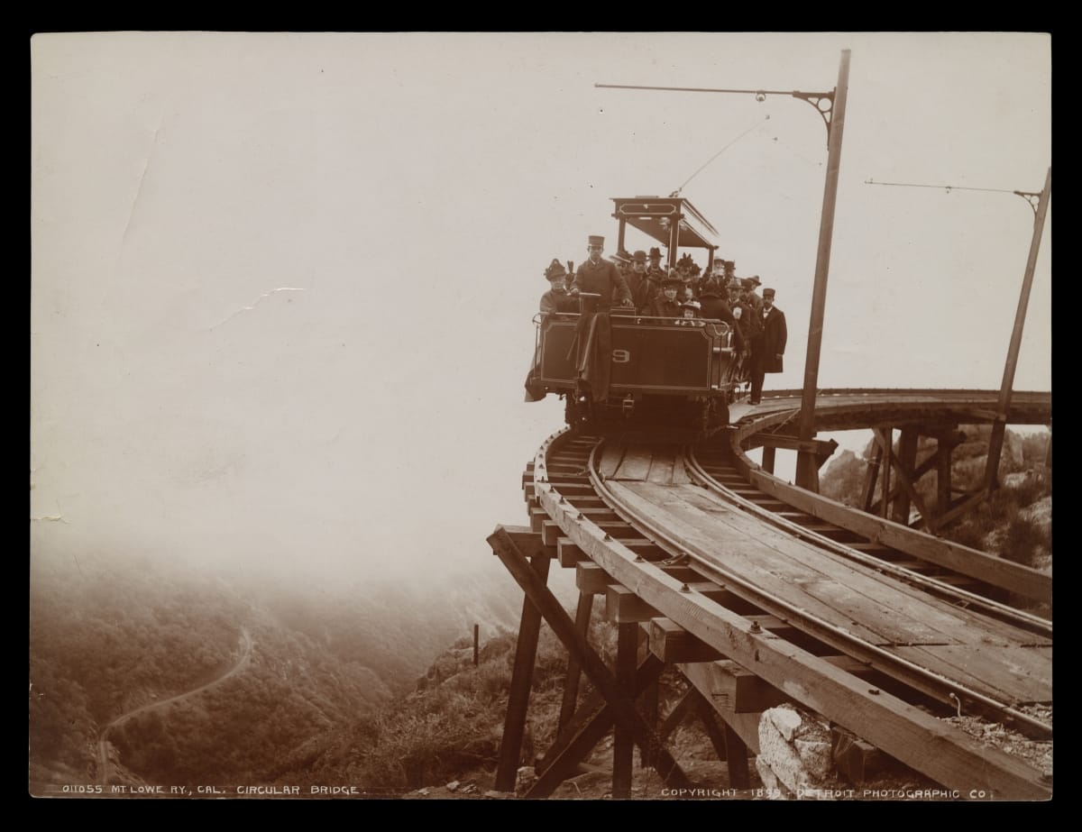
Sightseers aboard Cable Car on Circular Bridge, Mt. Lowe Railway, California, 1899
From 1895 to 1924, the Detroit Publishing Company was one of the major image publishers in the world. The company's wide-ranging stock of original photographs documented life and landscapes from across the nation and around the globe. From the tens of thousands of negatives, the company created prints, postcards, lantern slides, panoramas, and other merchandise for sale to educators, businessmen, advertisers, homeowners and travelers.
- Herald Square, New York City, 1904 (Photograph with Handwritten Production Notes) - From 1895 to 1924, the Detroit Publishing Company was one of the major image publishers in the world. The company had a wide-ranging stock of original photographs, including many scenes from across North America. This image captured a variety of traffic -- including pedestrian, horse-drawn, automotive, streetcar, and elevated rail -- on the move in Manhattan's Herald Square.
- 1904
- Collections - Artifact
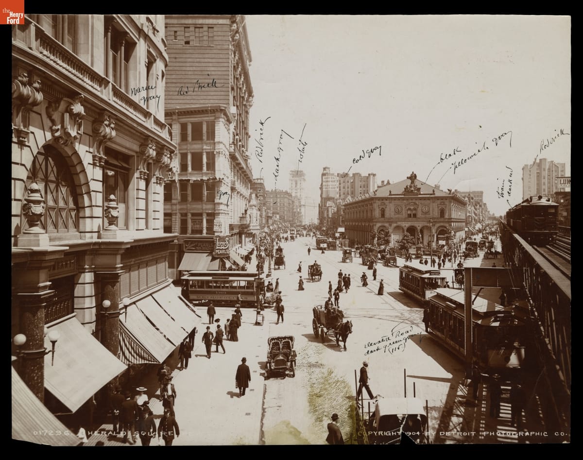
Herald Square, New York City, 1904 (Photograph with Handwritten Production Notes)
From 1895 to 1924, the Detroit Publishing Company was one of the major image publishers in the world. The company had a wide-ranging stock of original photographs, including many scenes from across North America. This image captured a variety of traffic -- including pedestrian, horse-drawn, automotive, streetcar, and elevated rail -- on the move in Manhattan's Herald Square.
- Wabash Avenue, Looking North from Monroe Street, Chicago, Illinois, circa 1900 - In turn-of-the-twentieth-century downtown Chicago, pedestrians and horse-drawn vehicles shared the streets with streetcars and elevated rail.
- circa 1900
- Collections - Artifact
Wabash Avenue, Looking North from Monroe Street, Chicago, Illinois, circa 1900
In turn-of-the-twentieth-century downtown Chicago, pedestrians and horse-drawn vehicles shared the streets with streetcars and elevated rail.
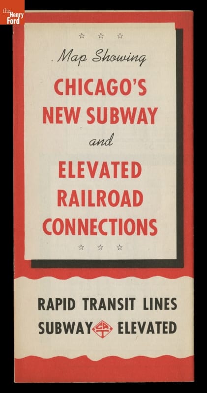
- "Map Showing Chicago's New Subway and Elevated Road Connections," circa 1940 - This map introduced Chicagoans to the Chicago Rapid Transit Company's new subway lines, which would complement and relieve traffic on existing surface and elevated rail lines. When the CRT opened their subway lines in 1943, Chicago's rail lines, buses and streetcars were all run by separate, private companies; they merged in 1947 to become the municipally owned Chicago Transit Authority.
- circa 1940
- Collections - Artifact
"Map Showing Chicago's New Subway and Elevated Road Connections," circa 1940
This map introduced Chicagoans to the Chicago Rapid Transit Company's new subway lines, which would complement and relieve traffic on existing surface and elevated rail lines. When the CRT opened their subway lines in 1943, Chicago's rail lines, buses and streetcars were all run by separate, private companies; they merged in 1947 to become the municipally owned Chicago Transit Authority.
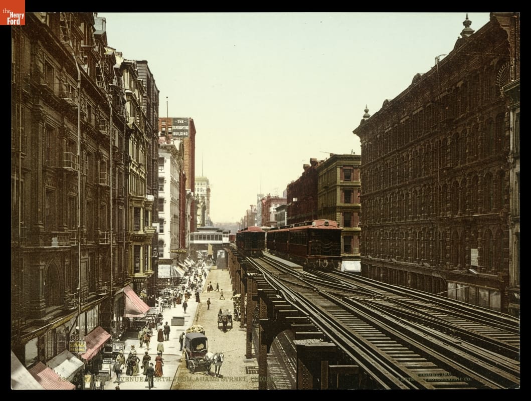
- Wabash Avenue, North from Adams Street, Chicago, 1900 - Some cities built municipal elevated urban railways to move people quickly. This postcard shows the Chicago "L" about 1900. Note the pedestrians and horse-drawn vehicles on the street below.
- 1900
- Collections - Artifact
Wabash Avenue, North from Adams Street, Chicago, 1900
Some cities built municipal elevated urban railways to move people quickly. This postcard shows the Chicago "L" about 1900. Note the pedestrians and horse-drawn vehicles on the street below.
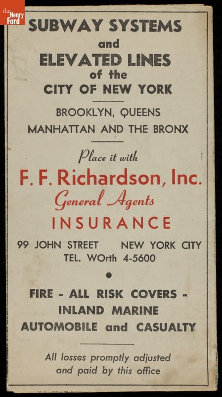
- Advertising Brochure, "Subway Systems and Elevated Lines of the City of New York," circa 1930 - This map of New York City transit systems was produced in the 1930s as advertising material for an insurance company. The map includes subway routes, points of interest-and information about F.F. Richardson, Inc. insurance.
- circa 1930
- Collections - Artifact
Advertising Brochure, "Subway Systems and Elevated Lines of the City of New York," circa 1930
This map of New York City transit systems was produced in the 1930s as advertising material for an insurance company. The map includes subway routes, points of interest-and information about F.F. Richardson, Inc. insurance.
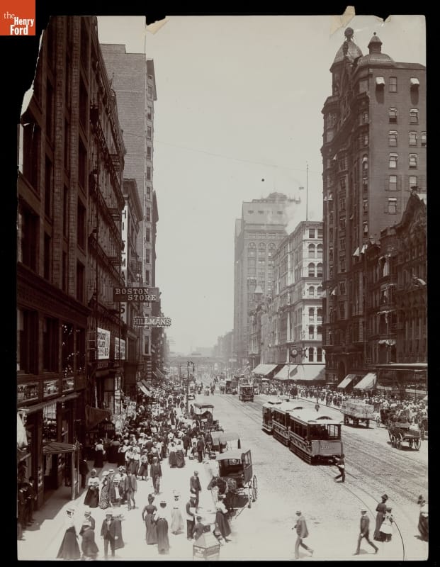
- State Street, Chicago, Illinois, circa 1900 - Chicago's population boomed in the last decades of the 19th century. This Detroit Publishing Company photograph shows bustling pedestrians, streetcars, and horse-drawn traffic on one of the city's busiest streets.
- circa 1900
- Collections - Artifact
State Street, Chicago, Illinois, circa 1900
Chicago's population boomed in the last decades of the 19th century. This Detroit Publishing Company photograph shows bustling pedestrians, streetcars, and horse-drawn traffic on one of the city's busiest streets.