Search
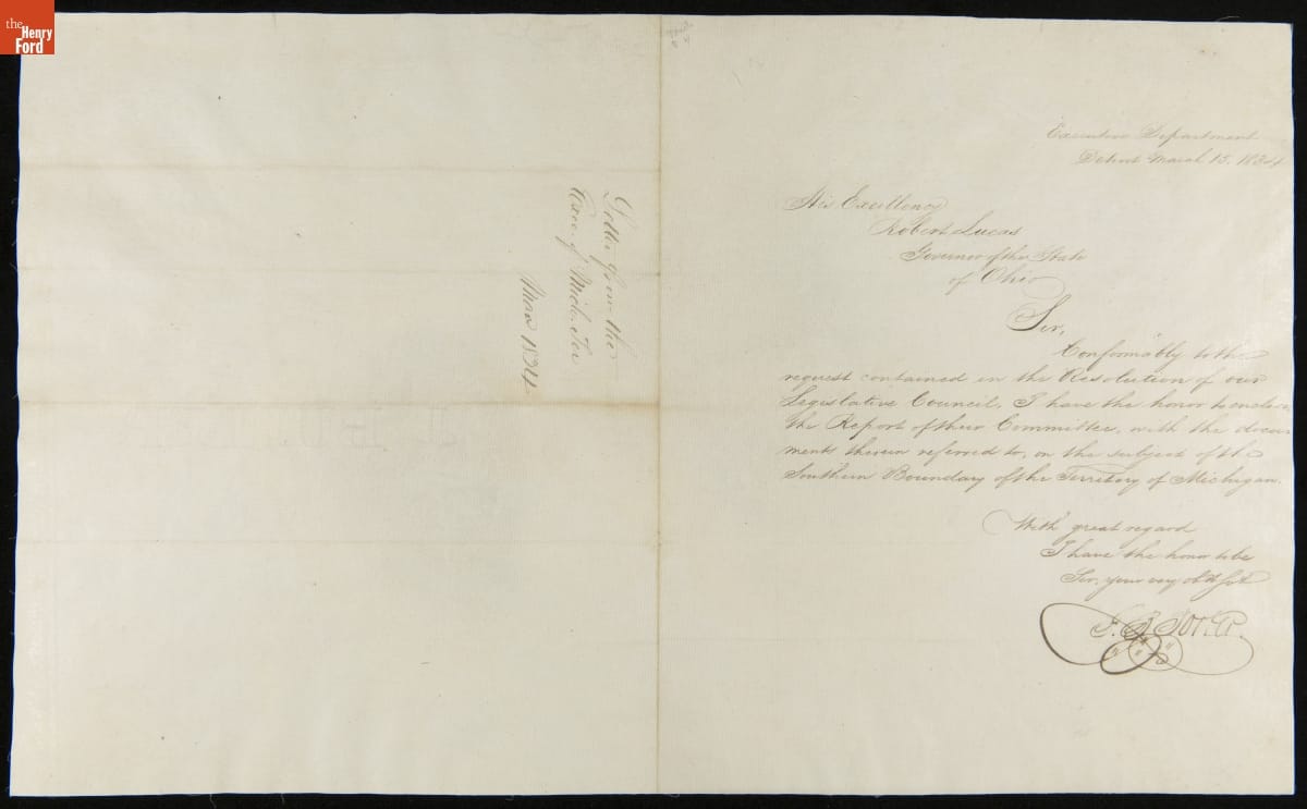
- Letter from George B. Porter to Robert Lucas, March 15, 1834 -
- March 15, 1834
- Collections - Artifact
Letter from George B. Porter to Robert Lucas, March 15, 1834
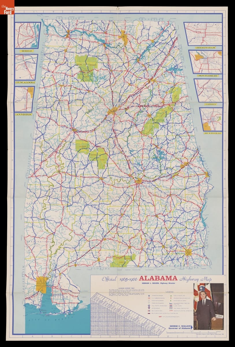
- "Alabama Official State Map," 1965-1966 -
- 1965-1966
- Collections - Artifact
"Alabama Official State Map," 1965-1966
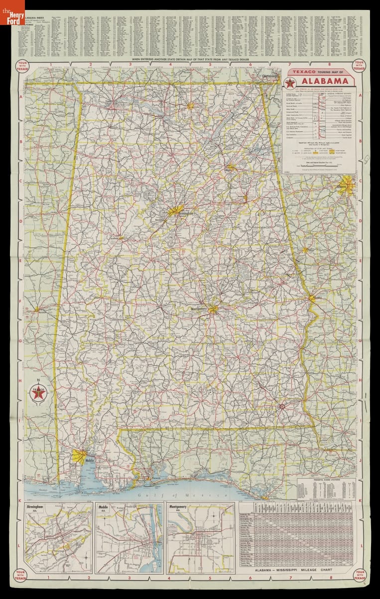
- Map of Alabama with a Special Map of the Southeastern United States, 1960 -
- 1960
- Collections - Artifact
Map of Alabama with a Special Map of the Southeastern United States, 1960
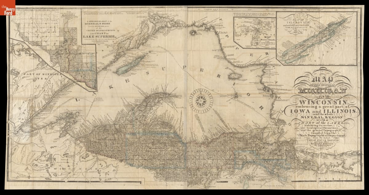
- "Map of the States of Michigan and Wisconsin, Embracing a Great Part of Iowa and Illinois," 1855 - This map shows Michigan's Upper Peninsula as it appeared in 1855. That year, construction crews completed the first lock at Sault Ste. Marie, Michigan, which allowed boats to travel uninterrupted between Lake Superior and the other Great Lakes. The lock made it possible for the state to more fully tap this region's rich copper and iron deposits.
- 1855
- Collections - Artifact
"Map of the States of Michigan and Wisconsin, Embracing a Great Part of Iowa and Illinois," 1855
This map shows Michigan's Upper Peninsula as it appeared in 1855. That year, construction crews completed the first lock at Sault Ste. Marie, Michigan, which allowed boats to travel uninterrupted between Lake Superior and the other Great Lakes. The lock made it possible for the state to more fully tap this region's rich copper and iron deposits.