Search
- "Strip Map of Lincoln Highway," 1929 - The Lincoln Highway, dedicated in 1913, ran from New York City to San Francisco, California. It was America's first cross-country highway. Using limited funds, it was mostly a patched-together series of existing dirt roads. But the publicity it generated raised public awareness of the need for better roads. Texaco included travel tips with this pocket map they published in 1929.
- 1929
- Collections - Artifact
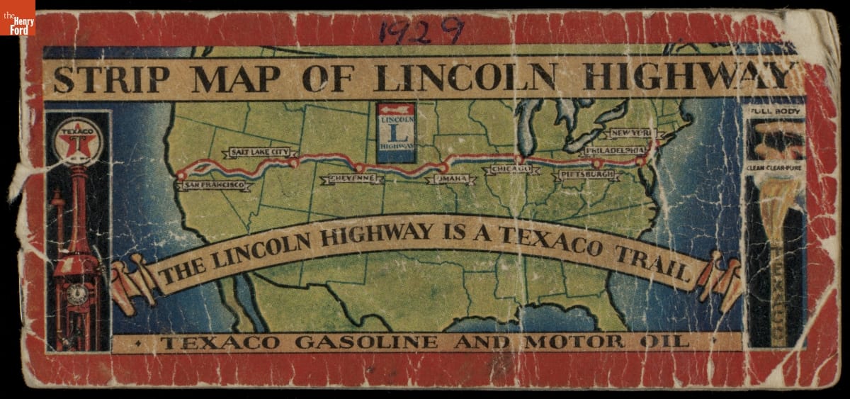
"Strip Map of Lincoln Highway," 1929
The Lincoln Highway, dedicated in 1913, ran from New York City to San Francisco, California. It was America's first cross-country highway. Using limited funds, it was mostly a patched-together series of existing dirt roads. But the publicity it generated raised public awareness of the need for better roads. Texaco included travel tips with this pocket map they published in 1929.
- TripTik Map for Detroit, Michigan to Fort Lauderdale, Florida, 1951-1952 - The TripTik, AAA's iconic planning guide, provided travelers with destination directions, points of interest, and a list of services and accommodations available along the way. This guide from the early 1950s described the route from Detroit, Michigan, to Lake Wales, Florida.
- 1951-1952
- Collections - Artifact
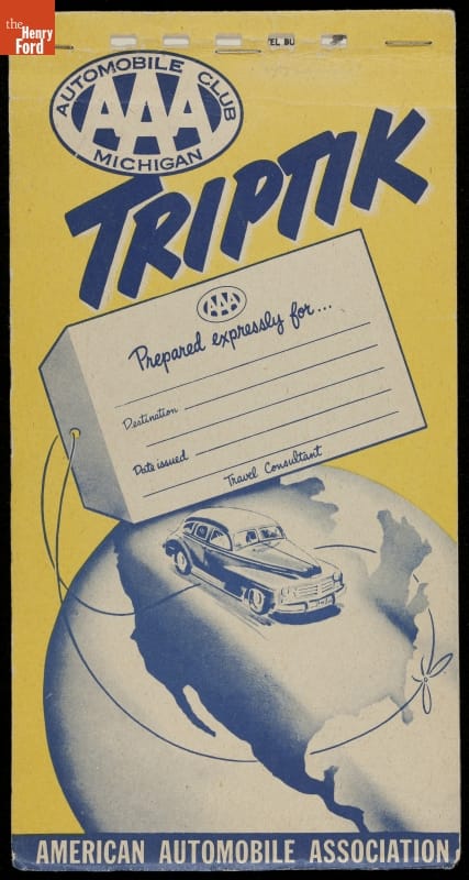
TripTik Map for Detroit, Michigan to Fort Lauderdale, Florida, 1951-1952
The TripTik, AAA's iconic planning guide, provided travelers with destination directions, points of interest, and a list of services and accommodations available along the way. This guide from the early 1950s described the route from Detroit, Michigan, to Lake Wales, Florida.
- Status of Work on Aerial Navigation Strip Maps Being Published by the Army Air Service as of February 25, 1925 - Navigating in an early airplane -- without the benefit of sophisticated cockpit instruments or radio communication -- wasn't easy. The U.S. Army, in cooperation with the U.S. Post Office, established a network of flyways across the country. These routes were marked with lighted beacons, creating reliable paths that pilots could follow day and night.
- February 25, 1925
- Collections - Artifact
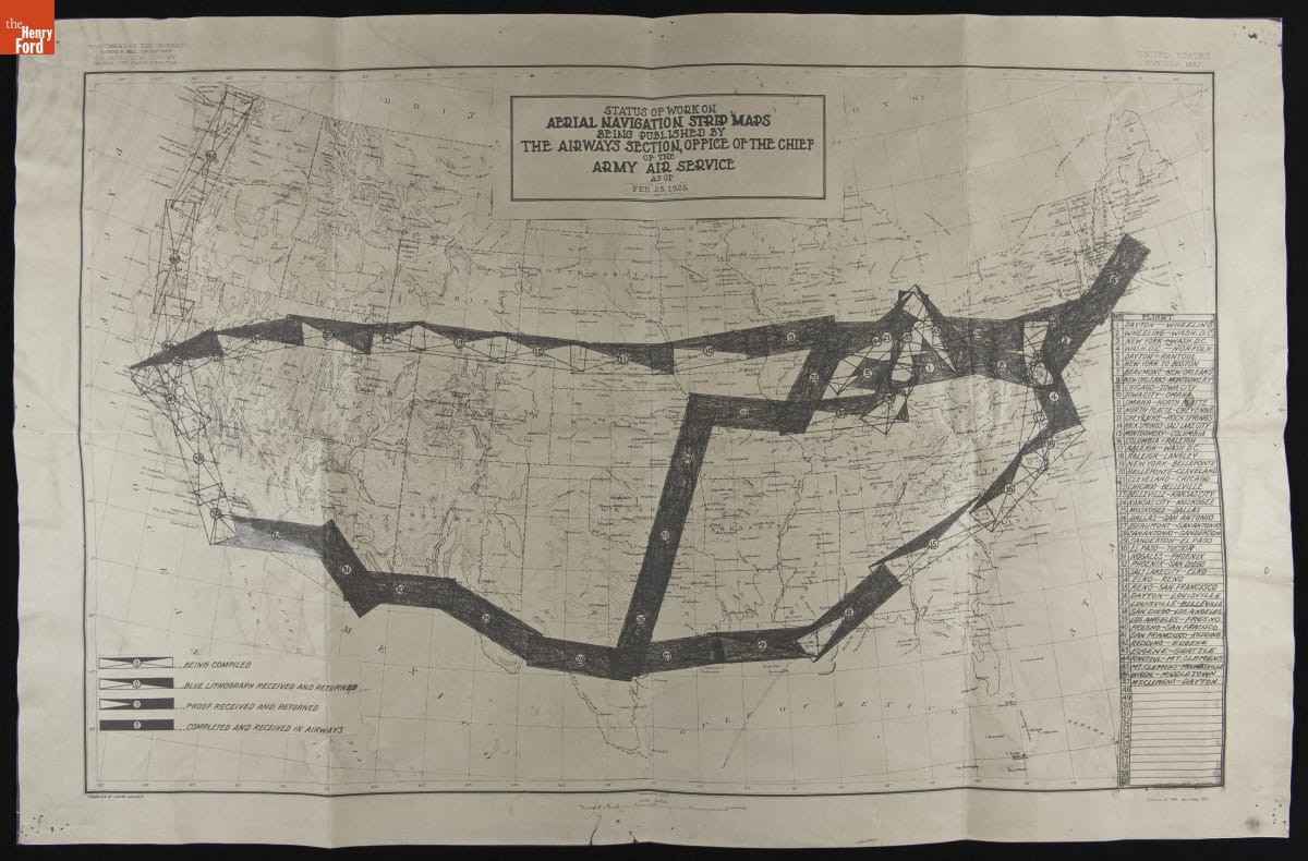
Status of Work on Aerial Navigation Strip Maps Being Published by the Army Air Service as of February 25, 1925
Navigating in an early airplane -- without the benefit of sophisticated cockpit instruments or radio communication -- wasn't easy. The U.S. Army, in cooperation with the U.S. Post Office, established a network of flyways across the country. These routes were marked with lighted beacons, creating reliable paths that pilots could follow day and night.
- Photographic Automobile Map, Chicago to Milwaukee, 1905 - Early travel guides used hand-drawn arrows on photographs to direct drivers to their destinations. A Photographic Automobile Map from 1905 helped motorists unfamiliar with the route navigate from Chicago to Milwaukee.
- 1905
- Collections - Artifact
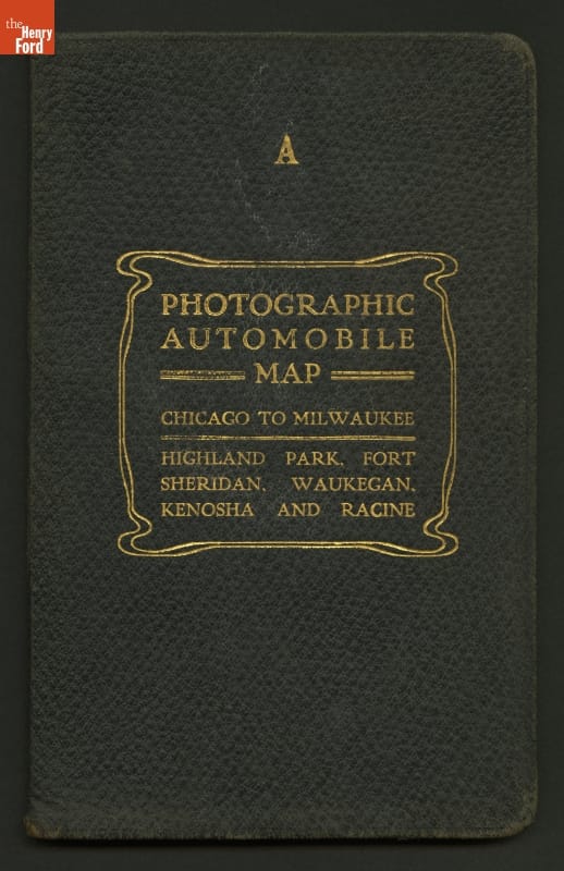
Photographic Automobile Map, Chicago to Milwaukee, 1905
Early travel guides used hand-drawn arrows on photographs to direct drivers to their destinations. A Photographic Automobile Map from 1905 helped motorists unfamiliar with the route navigate from Chicago to Milwaukee.