Book, "Smiley's Atlas for The Use of Schools and Families," 1839
THF110172 / Book, "Smiley's Atlas for The Use of Schools and Families," 1839
01
Artifact Overview
This world atlas with lovely color maps would have been found in fortunate American homes and schools. The atlas reflects modern knowledge of natural geography in most ways, but not all (the shape of Michigan, for instance). The names, borders and even existence of countries have changed since 1839. Most maps include illustrations the mapmaker likely saw as symbolizing that land.
Artifact Details
Artifact
Atlas
Date Made
1839
Place of Creation
Creator Notes
Complied by Thos. T. Smiley. Published by Hogan and Thompson, Philadelphia, Pennsylvania.
Collection Title
Location
By Request in the Benson Ford Research Center
Object ID
2013.0.5.15
Credit
From the Collections of The Henry Ford.
Material
Paper (Fiber product)
Technique
Hand coloring
Color
Multicolored
Dimensions
Height: 11.75 in
Width: 9.75 in
Keywords |
|---|
02
Related Content
 Set
SetOne-Room Schools
- 42 Artifacts
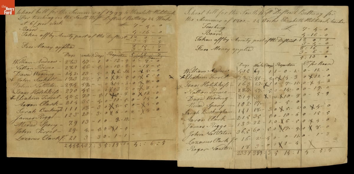
In the early United States, schools were organized if the local community desired them, and generally parents had to pay for their children to attend. This is a hand-written bill from a teacher in Bethany, Connecticut. Parents were billed for their children's education as well as the teacher's board (food and shelter).