The Pennsylvania Turnpike
Share
share
Opened in 1940, the Pennsylvania Turnpike was the prototype for modern limited-access American highways. Financed by user tolls, the turnpike initially ran 160 miles across the Keystone State, connecting Harrisburg with Pittsburgh. It was soon extended 100 miles east to Philadelphia. Drivers appreciated the smooth pavement, gentle curves, and lack of stoplights. The turnpike became a tourist attraction in its own right.
THF104695
Photochrom, "River Drive from Laurel Hill, Fairmount Park, Philadelphia, Pennsylvania," 1900
Philadelphia, at the eastern end of Pennsylvania, has long been the state's largest city. It also played a significant role in American history as home to the debates over the Declaration of Independence and the Constitution. Philadelphia business and banking leaders advocated for better transportation links between their city and the rest of the state.
View ArtifactPanoramic View of Rivers and Bridges, Pittsburgh, Pennsylvania, 1908
Pittsburgh, at the western end of the state, sat at the head of the Ohio River and served as a gateway to the Midwest. Later in the 19th century, the city became the center of America's steel industry. Between Philadelphia and Pittsburgh lay Pennsylvania's capital at Harrisburg, and the Allegheny Mountains -- a major barrier to east-west travel.
View ArtifactConestoga Wagon, circa 1840
In the 18th and early 19th centuries, passengers traveled across Pennsylvania by stagecoach while freight often moved in Conestoga wagons -- named for the Conestoga River in Pennsylvania's Lancaster County. The wagon journey from Philadelphia to Pittsburgh took anywhere from 18 to 35 days, depending on how muddy the roads were during the trip.
View ArtifactMap of Canals and Railroads in Pennsylvania, circa 1837
Eager to speed travel and lower shipping costs, Pennsylvania began construction on an ambitious Main Line of Public Works in 1826. The system linked Philadelphia and Pittsburgh with a series of railroads and canals. The most complicated segment was the 36-mile portage railroad that hauled canal boats -- riding on flatcars -- over the Allegheny Mountains with mules and steam winches.
View ArtifactBroadside, "Pennsylvania Rail Road, its Necessity and Advantages to Philadelphia," 1847
Railroads -- cheaper to build and able to operate year-round -- proved superior to canals. The Pennsylvania Railroad (PRR) was charted in 1846 to connect Harrisburg and Pittsburgh entirely by rail. PRR extended east to Philadelphia in 1857. In time, PRR grew into one of America's largest railroads with lines connecting New York City, Washington, Chicago, and St. Louis.
View Artifact"Empire State Express (New York Central Railroad) Passing Through Washington Street, Syracuse, New York," circa 1908
PRR's archrival was the New York Central (NYC), which spanned the Empire State. When PRR backed a railroad paralleling part of NYC's mainline in the 1880s, NYC retaliated by planning its own route between Philadelphia and Pittsburgh. Construction started on significant portions of NYC's South Pennsylvania Railroad (SPRR), including some of its nine planned tunnels through the Alleghenies.
View ArtifactPortrait of John Pierpont Morgan, 1902
Financier J.P. Morgan believed that the fight between PRR and NYC would be ruinous for the railroads -- and possibly for the American economy itself. Morgan brought the presidents of both railroads together and facilitated a truce. Work on the South Pennsylvania Railroad stopped and, apart from a few short segments, the right-of-way was abandoned.
View Artifact"Strip Map of Lincoln Highway," 1929
In the early 20th century, railroads faced new competition from automobiles. Drivers lobbied for better roads. The Lincoln Highway, America's first transcontinental road, opened in 1913. Its route from New York City to San Francisco passed through Pennsylvania by way of Philadelphia and Pittsburgh. The route later became a part of U.S. Highway 30.
View ArtifactTravel Brochure, "The New and Extended Pennsylvania Turnpike," 1950
By the 1930s, growing traffic called for still better roads. That, combined with funding opportunities from Depression-era New Deal programs, inspired Pennsylvania officials to propose a "superhighway" across the state on portions of the abandoned SPRR roadbed. Bankers doubted such a long toll road could pay for itself, but a federal government grant allowed construction to start in 1938.
View ArtifactPennsylvania Turnpike Pennant, 1945-1960
The Pennsylvania Turnpike opened to traffic at 12:01 AM on October 1, 1940. Over its first four days, the turnpike attracted 24,000 vehicles. By the end of its first year, it carried more than 514,000 cars and trucks. Newspapers raved about the roadway. By 1941, at least five other states formed turnpike commissions to propose their own superhighways.
View Artifact"Pennsylvania Turnpike" Souvenir Plate, 1946-1958
The Pennsylvania Turnpike wasn't just a faster way to travel, it was a tourist destination in its own right. Americans had never seen anything like it -- a multilane road with no opposing traffic, no intersections, and no stoplights. Some motorists likened the turnpike to the mythical "yellow brick road" from The Wizard of Oz.
View ArtifactPortal and Tunnel on Pennsylvania Turnpike "America's Super Highway," 1940-1950
Just as the Allegheny Mountains vexed wagon roads, canals and railroads, they also challenged the Pennsylvania Turnpike. The turnpike crossed them with the help of seven tunnels. Six of those bores were adapted from partially built SPRR tunnels. Workers completed and enlarged the railroad tunnels to accommodate highway lanes.
View Artifact"America's Super Highway," A Tunnel on the Pennsylvania Turnpike, 1940
As the turnpike's traffic grew -- both in volume and in physical size -- the SPRR tunnels became inadequate. In 1968, engineers replaced 13 miles of the turnpike with a new alignment that eliminated three of the old tunnels. The turnpike's four remaining tunnels were expanded by boring additional parallel passageways through the mountains.
View ArtifactHoward Johnson's Motor Lodge, Harrisburg, Pennsylvania, circa 1962
The Pennsylvania Turnpike had 10 commercial service plazas directly on its route. They included gas stations and restaurants for fuel and food. Howard Johnson's operated the restaurants. In time, additional service stations, eateries and hotels were built farther from the turnpike to accommodate travelers.
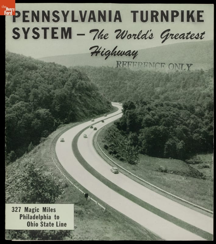
View Artifact"Pennsylvania Turnpike System - The World's Greatest Highway," circa 1952
As first built, the Pennsylvania Turnpike ran 160 miles between Harrisburg and Pittsburgh. Even before its 1940 opening, plans were made to extend the turnpike east to Philadelphia. World War II temporarily halted those efforts. The turnpike finally reached Valley Forge, just west of Philadelphia, in 1950. Later extensions pushed west to Ohio and east to New Jersey.
View ArtifactPennant, "Gettysburg, Pa.," 1940-1965
The Pennsylvania Turnpike seemed to bring everything along its route closer together. The previous six-hour car trip from Harrisburg to Pittsburgh was cut to two-and-a-half hours. The turnpike encouraged tourism with interchanges near popular destinations. Even Gettysburg National Military Park, which wasn't directly on the road, was only 30 miles from the nearest interchange.
View Artifact"A Colorful Souvenir Book of the Pennsylvania Turnpike System," circa 1952
Tolls made the Pennsylvania Turnpike possible. Motorists paid user fees based on the length of their trips and the size of their vehicles. In the turnpike's first year, revenue from tolls topped $562,000 -- easily beating projections. For passenger cars, the initial toll rate was about one cent per mile.
View Artifact"The National System of Interstate and Defense Highways," 1964
Inspired by Pennsylvania's turnpike, Congress passed the Federal-Aid Highway Act of 1956. It called for a 41,000-mile national Interstate Highway System built to similar standards. The network, as originally envisioned, was completed in 1992. The Pennsylvania Turnpike became a part of the Interstate system and received the appropriately patriotic -- though entirely coincidental -- designation Interstate 76.
View Artifact"Penna Turn-Pike, Tips for Your Turnpike Trip," circa 1970
The federal government paid 90 percent of the costs for new Interstate highways, with states paying the remaining 10 percent for routes within their respective borders. Most of the system was toll-free but, in the case of the Pennsylvania Turnpike (financed and built before 1956), the Keystone State was allowed to continue charging tolls.
View Artifact"Welcome to the World's Greatest Highway: Penna Turnpike," 1957
For decades, interchanges on the Pennsylvania Turnpike were numbered sequentially (Exit 1, Exit 2, Exit 3, etc.). Though easy to understand, Pennsylvania's system became quirky when newer Interstates numbered their interchanges based on mileposts. It caused problems when adding new interchanges too (Exit 1A, Exit 26A, etc.). Turnpike interchanges switched to milepost numbering in 2001.
View ArtifactPennant, "Pennsylvania Turnpike," 1940-1965
Since its opening, the turnpike's roadway and route have changed to enhance safety and reduce maintenance. Tolls have increased to pay for improvements and keep pace with inflation. But the Pennsylvania Turnpike remains a vital east-west link in the national highway network. Millions of motorists still travel America's first superhighway every year.
View Artifact

